Saturday, November 21, 2015

Navionics Autorouting


Application: iPad, iPhone iOS 6.0 or later, Android devices
Function: Marine navigation, charting, POI
Rating: *****
Cost: The app is Free with in app purchases

I have reviewed the Navionics apps in many previous blog entries.  They have continued to improve their apps over the years to include many useful features. Not only do they provide the latest up to date marine charts, they have provided additional features including the Navigation Module, Sonar Charts, Plotter Synch, Advance Map Options and most recently Auto Routing. These can all be purchased within the app for an additional charge.

Navionics Boating app recently added an amazing new feature that greatly improves the routing function, it is called Auto Routing. It does exactly what it sounds like.

This is not the old routing function where you have to manually add way point after way point to create a route.  Routing can now be one with a few touches of the screen on your mobile device.

The improved automatic routing algorithm now takes into account depths, shoals, hazards and your boats draft to determine the safest and fastest route from point A to point B.

Features:

  • Nautical charts
  • Sonar charts
  • Community Edits
  • Advanced map options
  • Navigation Module
  • Dock to Dock auto routing
  • POI
  • Tracks 
  • Routes 
  • Measure distance and bearing
  • Satellite map options
  • Sych tracks
  • Free NOAA US raster charts
  • Magazines and Guides
  • Plotter Synch to your Raymarine chart plotter

To get started you are going to need the free Navionics Boating app. Download it from the AppStore and fire it up.  Next you are going to have to purchase some charts.  The Auto Routing feature is included with the purchase of any Navionics+Chart set.  So make sure to download a chart set for your area in that format.

The Auto Routing feature is going to need to know some basic details about your boat, so select the Menu button and then go to Settings and Boat Settings.

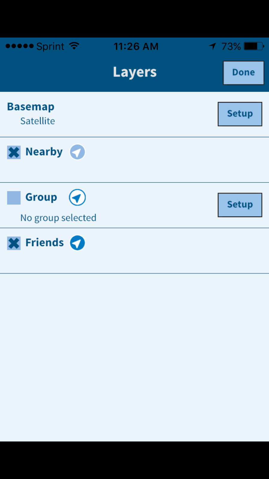
 Here you can fill in the draft, cruising speed, fuel consumption and sonar sensor depth of your vessel. This data helps the routing algorithm determine the safest route for your vessel in shallow areas.

Major Disclaimer: All boaters should not rely solely on the Auto Routing feature to create their routes.  Please review the route to make sure it does not take you across any shallow areas or onto any wrecks, rocks, shoals or obstructions. Do not rely solely on the auto routing feature for your navigation.

To create an automatic route, tap the Route button and then select Automatic Route.  You will then be prompted to select a start point and end point for your route.

The app will automatically begin calculating the safest route. If the route cannot safely be done the route line will show a red line with caution markers showing the areas that are too shallow for your yacht.

If the route line is all blue the route has been successfully calculated and created. Again, please review the route before blindly following the route with your vessel.

Route trip information is displayed across the top of the iPhone display showing latitude and longitude for the two points. Trip distance, trip time and fuel usage are calculated using the information you provided about your yacht.

I tried to create some routes in some pretty difficult inter coastal waterway areas.  The auto routing functioned worked fairly well in calculating the route.

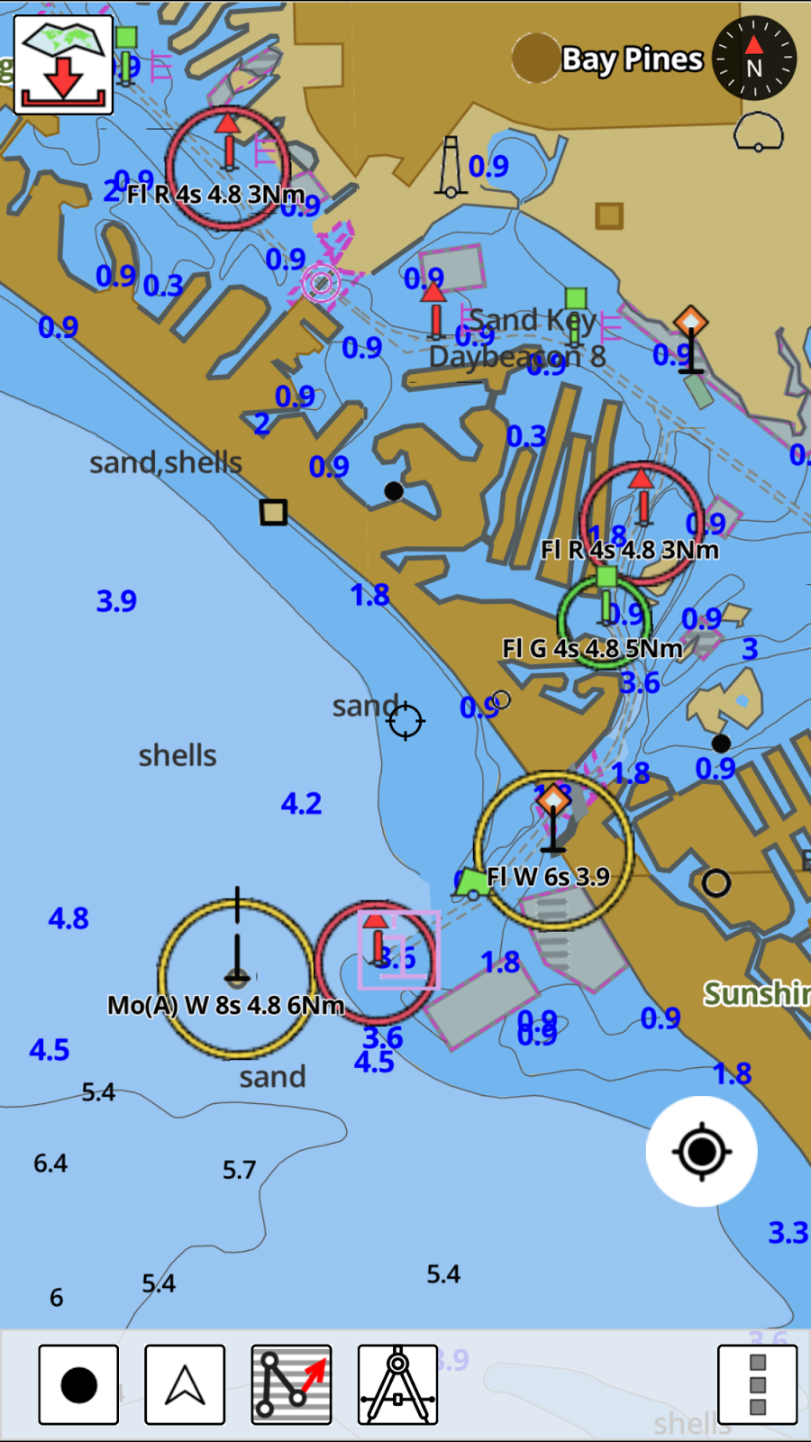
As you can see in the image of the Fort Myers Florida area it calculated the route out of the inter coastal waterway to the ocean correctly.

Note that the start of the route was shown with some shallow areas with the color red. Take note and zoom in to check these areas to make sure you have enough depth for your vessel.

I wondered if the auto routing feature would work while not connected to an Internet connection. I turned off my WiFi and cellular connections and tried the auto routing feature, I was surprised that it did work. So, you can use it while out of cell range.

I also wondered if it could be used to auto route long passages. I tried one from Fort Myers to Key West and it took a while to calculate but it did plot a nice route entering the channel from the north into Key West.

I tried a even longer route from Fort Lauderdale to the Virgin Islands and was surprised to find that the app would auto route a trip that long. The longer the route the longer it takes to calculate the route.  On my iPhone 6Plus it did take about fifteen minutes to calculate the route.

The route had a distance of 951 nautical miles. The trip time only showed 9 hours and 46 minutes and using only 9.8 gallons of fuel which are wrong. This did not seem right compared to the cruising speed of 4 knots and fuel consumption of 1 gallon per hour that I entered in the Boat Settings section.

In reviewing the route there were several questionable areas through the Bahamas where I would change the route, but otherwise it did a decent job.

I am not sure exactly what the distance limitations of the app are.  I will continue to play with several long routes to determine if there is a limit. The app does require that you have the charts downloaded for the area that you will be auto routing in or through.

I am impressed with the new auto routing feature and just how easy it is to select two points and let the app do the rest.

I plan to always review the route to make sure it does not take me into any areas that may put by boat in danger.

This is a another new and innovative feature that is a first for the marine app industry. I can't wait to see what will come next.

What other features would you want automated in your boating and cruising life?

~~~ Sail On ~~~ /)
Mark


Saturday, November 14, 2015

SeaPilot 3.85 Weather Routing

Application: iPhone, iPad, iPod Touch, Android versions also
Function: Chart Plotter, Routes, Marks, GPS, AIS, Instrument dataRating: *****
Cost: App is free, in app purchases for all features.

I reviewed the previous version of SeaPilot back in November of 2014. Since then their programmers have been busy adding features including a weather routing option.

The new version 3.85 of SeaPilot released in September 2015 has some new features that sailors will enjoy. Weather routing is a very important tool to have when your crossing oceans or a major body of water.  The routing feature will provide you the optimal route to take with the forecasted wind conditions.  SeaPilot uses the wind and current weather related GRIB files and the polar diagrams of your particular boat to provide the best route.  This routing will save you time and get you to your destination sooner.

GRIB files are a gridded binary files that can be downloaded from several weather related sources on the Internet.

These files include a grid display of current and wind strengths and direction. The GRIB forecast data can then be stepped through to see the varying conditions over the next 6 to 12 hours.

Updated forecasts are provided regularly by several weather services around the world so they are readily available. An Internet or satellite connection will be needed to download the most up to date files.

To GRIB files provide the forecast of the wind but the app also needs to know the polar diagram data for your specific vessel to provide the routing information. Polars are a representation of the sailing yachts performance and velocity made good at various sailing angles to the wind. Your sailboat manufacturer should be able to provide this data to you. If not find a boat similar to yours and use that polar data.

There is also an app to calculate your polar diagram data if you can't find a boat similar to yours.  It is called iPolar which I reviewed back in December of 2012 on this blog. This app will help you develop a custom polar diagram for your yacht.

The app requires inputs for your boats length, displacement, length at water line, main, jib and spinnaker sail area. Once those values are in the wind speed can be selected.  The tabular data is listed under the values page. This is the data that the SeaPilot app will need to do your weather routing.

The SeaPilot app weather routing simply provides the fastest route between two points regardless of water depth and shoals. So pay particular attention to depths along the optimized route to make sure the depth is adequate for your vessel.

The routing feature can be acquired with an in-app purchases of $59.70. See all the in app purchases listed on the SeaPilot website.  The weather routing feature also requires that you purchase the Marks, Routes and Past Tracks module for an additional $10 USD. US chart sets will cost you about $10 per set also to track your position and display the routes on NOAA vector charts.

The addition of weather routing to SeaPilot is welcomed but it falls short of the weather routing offered in the Weather 4D Pro and Predict Wind apps.  These apps both provide multiple weather models and multiple routing options. If your serious about looking into weather routing for your yacht, I would check those apps out for sure.

~~~ Sail On ~~~ /)
Mark

Sunday, October 25, 2015

ActiveCaptain Locations Version 1.2

I reviewed Jeff Siegel's Locations app back in June of this year. I would have though he would have taken the summer off  to enjoy some of that great Maine weather. Instead, he has been busy adding some great new features to his Locations app.

To get started you will need to get an ActiveCaptain account which you can then use to login to your eBoatCards account.  Not sure why they require two accounts, it would be much easier if there was only one log in and account required. The account is free so just sign up once to register.

New Features:
  • Session Mode selection of Send and Receive or Receive only 
  • Layered base map overlays
  • Group layers
  • Signal K support
  • Menu selections for Settings, Layers, Messages and Help
  • Scrollbars setting for desktop version
  • Dot Icon for member location data older than 24 hours
  • Graphic display of boats current course in the Search(magnifying glass icon)
  • Bing, OpenStreet, Satellite, NOAA charts and Aqua Maps base map layer options
The Locations app is not only available for you mobile device but is also able to run on PC, iOS and Androind devices.

The first thing you will notice new about the app when you start it up is the selection of a session mode. At this point you can choose to Send and Receive locations or just Receive Locations of friends and not upload your position.  This is just another level of security that was added to the app.  You can always change this mode by going to the Settings menu and selecting Session Mode to change it later.

Your GPS location is shown on the map as an arrow icon. If no GPS location is being received the icon will display red.

The icon will display dark blue if your device is receiving GPS and sending your location.

The icon will display white if your device is receiving a GPS signal but not sending your location.  The option to send your location or not can be set up with the session modes.

Find: 
The Magnifying Glass icon in the lower left side of the main screen activates the new find feature and options.

This is used to find other eBoatCard users and your boating friends. Options can be selected to show your friends, groups, nearby boats and stationary boaters.

Nearby members that are within a 5 mile radius will be shown with as a light blue icon with a white boarder. Group boater icons will be shown as white with a dark blue border. Friends will be shown as dark blue bordered by white.

Tapping any of the icons will show the latest information received from that member. Tapping the bolded boat name will open up their eBoatCards data in a separate web browser.

The Search bar will help you quickly locate boaters by simply typing in their name.

Your list of friends will be listed in the lower section and can be sorted by name, distance and data age. As you can see I just have one friends so far. Jeff was nice enough to accept my friend request.  Requesting Friends is done in the eBoatCards application and is much like requesting friends on FaceBook.

Settings:
The new menu button now shows selections for Settings, Layers, Messages and Help.

The Settings section provided selections to change some of the display options, sounds, units and GPS data. The display options include selections of large, medium or small user interfaces. This is great for many of us old boaters who need larger text. The Keep On options lets the app remain on and not go into sleep mode. This will constantly display the screen so make sure your device is plugged and charging to prevent your battery from running down.

The + and - zoom buttons can be togged on or off. If your are familiar with the pinch to zoom feature these are really not needed.

The Follow mode has options for Course up, Heading up and North up. These change the orientation of the icon to the map or displayed chart.

Sounds can be toggled on or off to alert you when friends, groups or nearby boats are located.

There are options to select metric or English units for distance, depth, height and location.

The app allows the use of your devices internal GPS or options to select NMEA 0183 or Signal K over WiFi. Locations has the ability to show your location using the DeLorme and SPOT satellite location devices. These are set up in the eBoatCards website.

Layers:

Locations provides several new maps and charts options. There are options to view OpenStreet 1 or 2, Bing Map, Satellite, NOAA raster charts and Aqua maps.  NOAA raster charts are copies of the old NOAA paper charts which are a powerful navigation aid.

The Aqua Maps are a vector representation of the marine charts used by the Aqua Maps app I reviewed some time ago. With all these options it should be easy to locate other boaters and help aid you with some basic navigation.

Other custom base maps can be added with the setup of the Base map name and the tile server list.

More new features have been promised in the very near future.  The ActiveCaptain messaging system will be integrated with the eBoatCards system and the functionality to send, receive and archive will be made available in the Locations app.

Many of you are familiar with the DragQueen anchor alarm app. This functionality will be moved into the Locations app along with remote monitoring capabilities.

All the great ActiveCaptain crowd sourced points of interest will also be integrated into the Locations app at some point. This data will be able to be used offline in case you lose your Internet connection or are way from WiFi.

As you can see, the ActiveCaptain crew is hard at work providing all these amazing apps and features to you absolutely free.  So there is no reason not to download the app an get started today.

~~~ Sail On ~~~~/) Mark


Thursday, September 10, 2015

Swell Avantage Boating Location App

Application: iPhone, iPad, iPod Touch, iOS 8.0 or later
Function:Marine GPS tracking and location
Rating:*****
Cost: Free

Swell Advantage is a brand new app just released this summer in July of 2015. It was developed by the Novia Scotia based Canadian group called Swell Advantage, ahh!  Co-founders Iaian Archibald and Craig Sheppard wanted to develop a different kind of app to bring boaters together on the water.

I was recently contacted by Mike Hardy from Swell Advantage. He was excited about the new app and wanted me to check it out and review it if possible. I am always looking for new apps to review so I said, heck yah!  So, lets lift the hood and see what this app has to offer.

The iOS version is out now and an Android version will be available soon.  SwellAdvantage is a new and different kind of boating app at first look!  It is meant for all levels of boater to use in marine navigation and to improve the social and safety aspect of boating.

Have you every asked the question, have our friends left the dock yet? Where are they now? Are the kids jet skiing with the neighbors? Where is the raft up party? SwellAdvantage helps answer these questions for you and helps guide you to your boating friends.

The main screen at left shows your present location with the arrow and range marker. The view can be changed from North up to Course up by tapping the arrow icon in the lower left of the screen.

The Menu is accessed with the icon in the lower right of the screen.  A list of your Friends is accessed with the icon in the top right of the screen.

The app provides functionality to easily notify you when your friends are out on the water and then it provides the tools to interact and locate them if you wish. This is not just another navigation app but a tool that enables socializing with other boaters.

SwellAdvantage allows you to share your position and other data including speed and heading so you can see your friends and they can see you on the water. Boating is a social sporting activity. Many boaters, sailors, paddle boarders or kayakers like to rendezvous with each other to raft up, share stories or have an impromptu race.

I have two kids who are always on the water. This app would be a great way to keep track of them when they are out boating, sailing, jet skiing, kayaking or paddle boarding.

The app not only provides notifications locally but you can also track your friends around the world when they go boating.

The app provides the option to share your location or not. A simple flip of the switch in the Friends menu will turn location sharing off. Your location is only shared while you are on the water and it is blocked when you are on land.  This will prevent your friends from tracking you when your not boating. The app must have some locational software that determines when you are on a lake, river, pond or ocean or land.

Features:

  • Viewable Maps, Satellite and Bathymetric displays
  • Display Course, speed and drift
  • Imperial or metric settings
  • Entering water notification
  • Custom boat data
  • Invite and add friends through your Facebook contacts
  • Visually locate your friends’ locations, distances, and headings on the water
  • Receive notifications when friends and family get on their boat
  • Location tracking is automatically disabled when you're on land
  • Users can manually disable On-Water location tracking
  • Your course due to drift, speed, and heading is visually shown on the screen
  • Unique interface that puts the user at the center of their boating experience
The app is pretty basic so far.  There are hints that the authors will be adding more marine navigation and charting features to future versions of the app.  I like what they have done so far and will be patiently waiting for the next update and the addition of more functionality.

What features would you like  to see added to the app? I personally would like to see NOAA charts, tracking, waypoints and routes to start with.

There are other apps similar to SwellAdvantage in the iTune Store. Many of the big name apps have AIS locational information through NMEA WiFi or through land based AIS systems that rebroadcast position data over the Internet.

ActiveCaptain recently came out with the Locations app which I reviewed recently.  ActiveCaptain is best know for their crowd sourced points of interest website and the many charting app that have embraced their POI database. They have a bigger vision in mind which will also connect boaters much like SwellAdvantage is trying to do.

So download the app now and start building your very own social boating network of family and friends! I bet it will even work this winter when those Canadian lakes freeze over and everyone goes ice fishing. 

~~~ Sail On ! ~~~ /)

Mark

Monday, September 7, 2015

iNavX Version 4.7.0 Brings New Changes and New Ownership

If you have updated your iNavX app recently you might have notice the new logo.  The logo is not the only thing that has changed. The creator of iNavX, Richard Ray has reportedly sold his iNavX, MacENC and GPSNavX applications to NavX Studios LLC.

You can check out their new website  for a list of all the features and support links.  It is cool to see if you click on the Tutorials tab on their website it takes you to my blog, i-Marine Apps site.  All the tutorials that I did for iNavX can be accessed there.

Over the years I have written numerous articles and tutorials about iNavX for a good reason.  It is still ranked #1 on my list of Best Marine Charting apps. I hope the new owners and developers will be as engaged at Richard was with the boating community.  The MacSailing message board for iNavX is a great resource for anyone wanting to learn all they can about the app and it's capabilities.

In the past there were only iPhone and iPad versions of the iNavX. MacENC and GPSNavX were programs for iOS computers.  I am sure there are many users out there that would love to see an Android version of the industry leading iNavX app. Maybe the new owners can work on that.

Over the years I have made many suggestion for improvements to the app. One of the main things I do hope the new owners address is the xTraverse website.  It would be so much easier to download charts if the app allowed in app purchases.  The whole process of paying for the xTraverse yearly membership and then purchasing charts through the site is a bit cumbersome and frankly more complicated that is has to be. I am not sure why is set up this way but in app purchases would be a great improvement.

I will keep an eye on the new iNavX team and report any new developments. Stay Tuned!!

~~~ Sail On ~~~~ /)
Mark


Saturday, August 29, 2015

Transas iSailor 50 % Off Chart Sale

I recently reviewed the new Android version of the Transas iSailor app. iSailor is listed in my top 10 Best Marine Charting apps on this blog. It is a full featured marine charting app capable of helping you navigate rivers, lake and coastal waters almost anywhere in the world.  I have written many reviews of the app over the years since it was introduced in 2010.

I got an email recently from iSailor notifying me that they will be having a chart sale this coming week. That's right if you want to buy some charts for you new app you can get them 50% off starting September 1-15th. Not all charts are on sale. Only a limited number are half off so make sure your selecting the right ones to get this special deal.

The chart folios on sale are limited to Canada, Europe, Australia and New Zealand. With each of these charts sets costing up to $24.99 each a 50% sale could save you some serious money.

To purchase charts in the iPhone or mobile Android phone version, pull up the Tools bar from the bottom of  the screen. Tap the Gear, (Settings) icon and Select the Chart Store.

If you have an iPad or Android tablet version of the app just tap the Gear icon in the lower right of the screen and then select the Chart Store.

Simply scan around the interactive map until you find the area you wish to purchase. Tap on the price button to purchase and download.

If your in the market for some new charts this would be a good time to stock up at half price.

Happy September 50% off iSailor Charts. Wahoo!!!!!


~~~ Sail On ~~~/)Mark


Saturday, August 22, 2015

i-Sailor for Android Devices

Application: Compatible Android tablets and phones
Function: Marine charting, AIS, GPS, navigation
Rating: *****
Cost: App download is free, with in app purchase for charts $4.99 to $24.99.

Transas i-Sailor is one of the leading apps in the Marine Navigation and GPS tracking area.  I have written extensively in many post about the iOS version of their i-Sailor app since it was released in 2010. Since that time may Android users have been very vocal about wanting a version they could run on their phones and tablets. Well after much pleading and outcry i-Sailor has heard you loud and clear and responded with an Android version. You can now download it on the Google Play store.

The functionality and features appears to be very similar to the iOS version. i-Sailor has evolved to be a full featured app including charts, routes, waypoints, tracking, weather, AIS, NMEA connectivity.  The navigation screen is clean and uncluttered allowing full view of the Transas's TX-97charts.

Features:
  • Internal GPS 
  • NMEA GPS over Wi-Fi (TCP connection Bluetooth NMEA GPS through the Android Location Provide or Bluetooth GPS 
  • Display of Charts and Routes
  • North Up, COG Up and Route Up chart orientations
  • Information on any vector chart objects
  • Free cursor, Point-To-Point and Own Ship referenced ERBL functionality
  • Navigational data: Position, Course (COG) and Speed Over Ground (SOG)
  • Route creation, Go To routes
  • Bearing to WP, Distance to WP, XTD
  • Time-To-Go and ETA to any selected waypoint ahead
  • Day and Night chart background colors
  • List of supported and tested devices with Android version 4.3.x (API 18) and higher:
Compatible Tablets:
  • Google Nexus 7 (2013)
  • Samsung Galaxy Tab S
  • Samsung Galaxy Note 8.0
  • Samsung Galaxy Tab Pro 8.4
  • Samsung Galaxy Note 3
  • Sony Xperia Z2 Tablet
Smartphones:
  • Samsung Galaxy S4
  • Lenovo S60
Other phones and tablets may be compatible but this is the list that i-Sailor had on their website. i-Sailor Android had GPS functionality that allows the user to select the onboard GPS of the phone or tablet. It also has the options of selecting NMEA and Bluetooth GPS options. The NMEA option is available for a $9.99 in app purchase. 

Charts:
The first thing you will want to do is download some charts. i-Sailor offer a wide variety of charts for most locations in the world. 

Select the gear icon to access the Settings Menu. From there select the Purchase Charts option to access the chart store. Charts range in price from $4.99 to 24.99. I downloaded the USA Gulf Coast Florida charts for $4.99.  The full list of Caribbean charts will run you $24.99.

The main chart and navigation screens are laid out nicely. The tablet version is shown in the image on the left. Selections for track up and north up are in the upper right of the screen. Indications for position information, latitude and longitude are displayed in the upper section also.

Course over ground, (COG) and speed over ground (SOG) are two of the most important navigation features most boaters need.

Waypoints and Routes:

The app has the ability to create routes with waypoints for more in depth navigation options. To create a route go to the Route icon in the Tools section. Select New Route, you will note that a waypoint box pops up on your screen. Place your finger on the waypoint and move it to the desired location. The latitude and longitude are displayed as you move the waypoint.  Select the Green + when you have it at the location you want. Tap the screen again to create another waypoint in your route. Continue doing this until the route is complete.

Navigating a route is one feature that not all marine charting apps have. i-Sailor provides this functionality and show Bearing to waypoint (BTW)and Distance to waypoint (DTW) along with Cross track error (XTR). Other navigation features include estimate time of arrival (ETA).

NMEA Options:

One of the most powerful features of i-Sailor Android is its ability to connect wirelessly through WiFi or Bluetooth to onboard instruments and external GPS devices. NMEA GPS can be accessed with an in app purchase of $9.99. This will unlock compatibility to receive GPS over WiFi connections through TCP and UDP protocols for the GGA, RMC, GLL and VTG sentences.

NMEA Compass rotation, Wind Sensor and Echo sounders can also be purchased for $4.99, and $8.99 each.  This level of connectivity with your onboard instruments give the app the information it needs to be a full fledged navigation chartplotter.

Wi-Fi Connection to an external AIS sensor is also provided with an in app purchase. This will allow the display of ships in your area on your mobile device. You will need to have a AIS receiver unit onboard capable of broadcasting the AIS data over WiFi to be able to receive this data.  

The Android version of the i-Sailor app is a welcome addition to the Google Play Store. I know the release of this version has made many Android users happy to finally have this app available to them. Please comment and let me know if you are using the app and how its working for you!

~~~ Sail On ~~~ /)
Mark


Friday, July 10, 2015

GPS Nautical i-Boating

Application: iPhone, iPad, iPod Touch
Function: Mobile Marine Navigation and Charting app
Rating:*****
Price: App is free, $14.99 US version

There are no shortage of marine charting apps out on the market. I have reviewed many over the years and I can tell within a few minute of using them if they are worthy of making my Top 10 ListGPS Nautical i-Boating is a solid marine charting app using NOAA vector charts and USACE inland rivers. It has many of the basics features needed to be a decent app including Waypoints, Routes, Tracks, GPS Tracking, Tides, Currents and sharing of routes, tracks and markers.  Although this is a nice list of features there are many competing apps with similar features.

One unique thing about GPS Nautical i- Boating is that it is available on many platforms. Versions are available for the iPhone or iPad, Android phone or tablet, Windows 8 phone, laptop or tablet, and Blackberry phone or tablet.  I know of no other marine app that is available over so many platforms. You should be able to find a version that works on your phone, tablet or laptop.

It is getting harder for may apps to compete with the "Big Boys" like Garmin and Navionics who provide free apps with many built in features. These apps also require in app purchases for charts and additional features.

Features:
  • GPU accelerated vector charts 
  • Query the details of Marine object Buoy, Lights, Obstruction.
  • Customizable depth(Ft/Fathom/Meter) and distance units (km/mi/NM)
  • Customizable Shallow Depth.
  • Record tracks, Autofollow with real-time track overlay and predicted path vector
  • Voice Prompts for marine navigation (requires GPS
  • 1ft / 3ft depth contour maps for anglers for selected lake maps.
  • Supports GPX/KML for boating route editing/import
  • Tide & Currents prediction
  • Seamless chart quilting of marine charts
  • Enter or import Waypoints
  • NOAA vector charts, USACE inland rivers and lakes
  • Create New Route/Edit Existing Routes
  • Move Points
  • Add points to an existing route leg
  • Delete / Rename points
  • Import GPX, KML & KMZ files
  • Plot/Edit Routes
  • Enter Waypoints
  • Share/Export Routes, Tracks & Markers
  • Reverse Routes
  • GPS Auto Follow
  • Real Time Track Overlay
  • Predicted Path Vector
  • Course Up (Text stays upright)
  • Speed & Heading
  • Route Assistance With Voice Prompts
  • Prompts when approaching a boating route marker
  • Continous distance and ETA updates
  • Alerts when sailing/boating off route
  • Alerts when boating in wrong direction
  • Record Tracks
  • Tide and Currents for US, Canada, UK, Germany & New Zealand
  • High/Low Tides
  • Tidal Current Prediction
  • Active Current Stations
  • Share tracks/routes/markers on Facebook & Twitter
  • Export tracks/routes/markers as compressed GPX files.
Multiple chart regions are supported and must be purchases separately. Coverage is fairly wide spread.
The app has a main navigation screen with several icons to help with setup and viewing of your position or course. The free app does not come with any charts. You will have to purchase charts for your regions. These range form $14.99 to 25.99 depending which area you need.

Once you have purchased charts you will be able to download the portion of the chart you need for navigation. In the upper left of the screen is the Chart Download icon. Tap this and you will be shown a tiled map overlay of the charts to download.

The green colored tiles show the ones I had previously downloaded. I tapped the tile to the right and it turned purple.  Simply press the Press to Download bar on the top to download your chart tiles to your device. More than one tile can be selected and downloaded at a time. The charts can then be used offline while out cell range.

Other icons  are displayed across the bottom of the screen. On the bottom left of the screen is the Record Track, Follow, Route, Measuring Tool and Menu icons. The Tracking feature is nice to have to see where you have travelled. Tracks are automatically saved and can be found under the Route icon.

The Follow feature icon is second from the left and is used to engage the follow mode. In follow mode the app will keep your position centered on the chart as you move. Additional details including speed and course are shown in the lower left of the screen.

The next icon is the Route Manager which allows the creation of new routes and viewing of saved routes, waypoints and recorded tracks. Importing of GPX and KML route files can also be done through this display.

Routes and Waypoints can also be renamed, deleted or edited from the Route Manger.

Select Create New Route to enter route creation mode. Several icons in the route manager are displayed across the top of the screen. The Hand icon allow you to pan around the display, the Pin icon allows placing a marker for a favorite fishing spot or a hazard.

The Route icon is selected to create a new route. Simply set the cross hairs to the location to make your first waypoint and tap the New Point box, pan to the next location and tap it again. Continue tapping to create all your waypoints within a route.  Next select the Save Icon to name and save your route for retrieval later.

As you create a route your can delete the last point if you make a mistake. Select the grey box "Delete Last".

It would be handier to have a Waypoint icon on the bottom menu to easily create and edit waypoints like the Route icon. To create or view waypoints the Menu icon has to be first selected. Under the New Waypoints selection you can use the current GPS location, enter the latitude and longitude or use the cursor crosshairs to make a waypoint. One unique feature is being able to Geo tag a photo at a waypoint.

The last icon in the lower right of the screen is the Menu icon. Menu features include Route Assistance, New Route, Settings, New Waypoint, View Waypoints, Tides and Currents, Search charts, Purchase Charts and Help features.

The Tides and Currents selection allows making favorites of your tide and current stations. The data is listed in tabular form. Once you save a favorite they all go into one list. It would be nice to have separate favorites lists or a way to differentiate so you can identify which ones are tidal and which one are for currents.

Voice prompts can be enabled within the Menu/Settings selections. Voice prompts can be set up to notify that you have reached a marker or waypoint. Notifications for ETA and distance are continuously updated. It will even alert you when you are off course or going the wrong direction.

GPS Nautical has done a great job with the basics and I am impressed with the presentation of the NOAA ENC vector charts. They are very bright and easy to read and contain many useful navigational aids.

Some features that I would like to see are some points of interest. Active Captain is used by many app developers and it is provided to them for free.  Very basic instrument data is displayed. Incorporation of NMEA 0183 instrument data over WiFi would be a nice feature also. With WiFi you could also add AIS to display nearby ships for collision avoidance. Some form of weather and display options for satellite maps would be a bonus also.

If your looking for a solid entry level app with great charts i-Boating just may be for you. Check it out in the app store and let me know what you think!

~~~ Sail On ~~~ /)
Mark

Wednesday, June 17, 2015

ActiveCaptain - Location App


Application: iPhone, iPad, iPod Touch iOS 5.1.1 or later, Android too!
Function: Boat Location Sharing
Rating:*****
Cost: Free

Active Captain is all about using technology to improve the yachting experience. The ActiveCaptain crowd sourced points of interest website has become a necessity when traveling the ICW or other coastal waters in many countries.  Jeff and Karen Siegel have taken their many years of cruising, interacting with other yachties and marina owners to develop some websites and apps that provide some unique features and capabilities. Their work helps cruisers become more aware of points of interest, obstacles, hazards, events and most recently other boating friends locations.


I reviewed the Companion App back in 2012. It notifies users of upcoming points of interest and hazards while they cruised. The Siegel's most recent creation is the Locations App which can be found on iTunes or the Google Play Store. Locations was created as an extension of their eBoatCards site to help boaters keep in contact and share location information between each other.
The eBoatCards site is an electronic way to blog, message and share information between individuals or marine groups. The website also has access to resources including many different cruising areas, boat products and systems, organizations and boat clubs. There is also a Services section that has lists of boat brokers, surveyors and transports companies. It is free to sign up for an account with just a user name and password. Other services are planned for the future.

The Locations app shares the users GPS data according to the privacy and profile settings in eBoatCards. It is not AIS but an Internet based location and tracking system.This version only shares data with your designated friends and nearby ActiveCaptain members. The Account Privacy Settings in eBoatCards allow you to control who can sees your location.
Location's Features:
  • eBoatCard friend integration
  • Base Maps include Bing, OpenStreets 1 and 2, Satellite and seamless NOAA Charts.
  • Friends location tracking
  • Delorme InReach and SPOT integration through eBoatCards
  • NMEA GPS option
  • PC and Mac GPS integration
  • Internal GPS option
  • Pan and zoom
  • Location tracking
  • Course up, north up and track up

The first thing you will notice are the high quality Bing, OpenStreet maps and NOAA charts available for display. The maps were a major drawback with the Companion App. Even after you downloaded the detailed maps they were not very functional. Neither the Locations app or the Companion app were meant for navigation purposes even though most users want to use them that way.

The main map and chart screen displays several buttons for navigation to the various functions of the app. Along the left side of the main screen you will see the Follow Button which looks like a bulls eye. This will only be visible when you are not in the follow mode. Tapping this will bring your location to the center of the screen and follow your position in real time. Course up, north up and heading up can be selected while in the tracking mode from the Settings Menu.

Just below the Follow Button is a Search Button. Tapping this takes you to the search screen where you can view the list of friends and search for new ones. Filtering is provided to list your contacts by Friends, Nearby, and Stationary. A handy sort feature lists your friends by Name, Distance and Data age.

Tapping on one of the listings will instantly display your friends location on the map or chart. Tapping the icon on the map will provide you the boats name, hailing port and location information.

The darker blue colored icons are your eBoatCard friends that have accepted your friend request while the lighter ones are Active Captain members.

If the position icon has a circle in it, the boat is not moving. If it has an arrow in it the arrow shows the last know course. If it has an Omni-directional icon, it was last know to be moving but course unknown.

Along the right side of the main display are the + and - buttons for zooming in and out of the chart or map.  You can also use your fingers to pinch in and out on the display for zooming as well. Below the zoom controls is the Orientation button which shows the orientation of the map settings. A north up icon is shown if that mode is set. Otherwise a course up or heading up icon will show those orientations of the base map.

I am the only eBoatCard member in SD, go figure!
The last icon in the lower right of the screen is the Menu icon. The Menu page allows you to login to ActiveCaptain, select your base map or chart, size of user interface, keep on, zoom buttons and follow mode.  Sounds can be turned On for notification of friends locations and new nearby boats. There is a section for selecting your unit preferences also.

The app has options to allow the user to use the Internal GPS of your phone or tablet or use a NMEA GPS source over WiFi. For external GPS use the app requires a WiFi network and settings for the IP address and port number. The Windows and Mac OSX versions allow the selection of USB or Serial and settings for the COM port and Baud rate.

If you own a SPOT or Delorme InReach satellite location device you can set them up in eBoatCards to download your real time position.  Log into eBoatCards, click the Edit Profile button on the top right of the screen. Next click the Boat Details tab at the top, scroll down to find the DeLorme inReach and SPOT configuration fields. Each item has a link to the detailed instructions for getting the configuration data for your device. This will allow your friends to keep track of you while you are out of cell phone range.

The Active Captain Locations program can also be used on your PC or MAC. Just login and you will have a full screen display of your friends locations.

With AIS being so prevalent and costs of AIS hardware coming down, I have to wonder if Locations will catch on. Once you look at the other features in the app it is well worth the free sign up price to join the community. Reports are about 6000 boaters have downloaded the Locations app. I guess it is catching on!

I know Active Captain has others features in the works to add to the Locations app. Rumor has it that the Companion app features will be moved into the Locations app.  There are plans for the addition of 20 new categories in the services section. Other future additions to the Locations app will include a Display Only Mode, Integrated Messaging, Group Support, Follow Friend, Sponsor Messaging and Drag King. See all the details of these latest developments on the Active Captain Blog.

Jeff and Karen will continue to be visionaries in the yachting community bringing technology and cutting edge apps to their users.  The cool thing is that all their websites and apps are all free to boaters. So there is not reason not to get involved and become a member of the Active Captain community.  It is way better than FaceBook!!!!

~~~ Sail On ~~~~ /)

Mark


Friday, May 29, 2015

Waterway Guides on iNavX

Application: iNavX Waterway Guides
Function: POI on US Coastal Waterways, Great Lake and Bahamas
Rating:*****
Cost: $9.99 per region, 50% off for iNavX users

If you have done any cruising on the ICW you are probably familiar with Waterway Guides. Waterway Guide has published their popular paperback guidebooks for years. The also publish a magazine and some mobile apps along with their very popular interactive web site (waterwayguide.com).  The guidebooks are used as planning tools by mariners and provide updated information for anchorages, alerts, navigation, marinas, fuel prices and more. The company has been recognized as one of the leaders in providing reliable travel and navigation guides for boaters and cruisers within the United States.

Waterway Guide has teamed up with Fugawi, the developer of the iNavX app to make available their guides and points of interest data to mariners.  Fugawi is a Canadian company who is a leader in providing online chart services through the Fugawi X-Traverse website. The Waterway Guides are now available on X-Traverse and provide geo-referenced data layers for use with the top-selling iOS iNavX navigation app.  The guides are available for 6 regions covering the East Coast of the United States, the Great Lakes, western Florida and the Gulf of Mexico, as well as the Bahamas. The Waterway Guides provide iNavX users five layers of data that can be overlayed on any of the chart products provided by Fugawi.

If you own the iNavX app on your iPhone or iPad the Waterway Guide regions can be downloaded from the X-Traverse website. All of Fugawi's charts are only available for purchase through this website.

The iNavX app is a full featured app that allows users to view real time positioning on charts displayed on the iPhone and iPad. Other features include creating waypoints and route and support for displaying NMEA instrument data over WiFi through TCP/IP. The app also displays AIS data of surrounding ships for collision avoidance.
iNavX can also provide weather and routing information to be incorporated on the chart display.

You will first need to set up an X-Traverse account to use the site. The Waterway guides are listed under Content and Pricing on the website. Select your platform and software from the Guides listed near the bottom under Cruising Data.

To enable the guides in iNavX on your mobile device select the gear icon in the upper right of the main display to open a menu. Select the Points of Interest list then select Setup and choose the Waterway Guide region you have purchased. Only one region can be displayed at a time. The Waterway Guide data should then show up overlayed on the iNavX charts. Simply select anyone of the icons to display the detailed information.

The Waterway Guide data is overlayed on the iNavX charts and includes layers for anchorages, navigation alerts, bridge height and lock opening times and contact information. The data is updated daily so you will have the most up to date alerts and notices. Data is updated directly from NOAA, the U.S. Coast Guard and the U.S. Army Corps of Engineers. Waterway Guide also incorporates observations from actual cruisers on the water with local knowledge. This data is then vetted for data integrity by Waterway Guides.

If you do a lot of coastal cruising or spend time on the Great Lakes or the Bahamas these guides are invaluable. Now that they are incorporated with iNavX it is easier than ever to access this information. The Waterway Guide information works offline so if you are out of cell range you can still get access to all the info. This will allow you to navigate the waters safely with all the latest alerts, POI and updates.

~~~ Sail On ~~~ /)
Mark


.

Saturday, May 16, 2015

Sailing Log by BoatBook

Application: iPhone, iPad, iPod Touch requires iOS 7
Function: Marine Tracking and Logging
Rating: *****
Cost: Free

I ran across an app the other day on FaceBook of all places.  There are getting to be a lot of marine companies who have FaceBook pages.

Sailing Log is the newest sailing log book app that can be found on iTunes. They also have an Android version found on the Google Play Store. It is made by BoatBook who appears to be a new developer in the marine app industry.  Sailing Log is fully automated so all you have to do is start boating or sailing and it senses and records your every movement. Heading, speed and distance are all recorded for you on each trip. There is also a companion website at www.boatbook.co where all your logs are kept and maintained for access on any device.

Features:
  • Works Offline
  • Automatic recording of your motor or sailing trip
  • Live worldwide maps and sea charts. Constantly updated by the best in GPS and mapping technologies
  • Real time sailing data at any point of your sail, cruise and voyage
  • Review your heading, speed and distance throughout the sail
  • Mark your waypoints and tag them by type of event
  • Log back to any leg of your voyage to look up your stats at past points
  • Sailing Log automatically saves your sailing route so you can log back to historic routes and review the sail at any time
  • Compatible for yachts, motor boats, kayaks and sail boats
  • Automatic recording of your sail on your maritime logbook
  • Innovative logbook software – get online and desktop records of your sailing trips by registering for free as a user.
  • Electronic logbook support – log into Boatbook’s website at any time to see all your app’s sailing log data online.
  • Maritime pro logbook for sailing, yachting and boating professionals at any stage of their career – fully functional marine log book.
  • Marine navigation & GPS software daily updated with the most accurate nautical charts.
  • Manage all your ship log book information, routes and trips in one easy to find app.
Screen Displays:  The main navigation screen is a two tone tan and blue type worldwide map. I would not call it a nautical chart because it does not provide much more than a map.  I am not sure where they get their map data but it does appear fairly detailed for most river, lakes, shoreline and coastal area. No depth or sounding data is provided.

All navigation features of panning and zooming work as expected with a touch of your finger.

Several icons are located on the screen for navigating the various features of the app. A Knot icon in the upper left of the screen provides access to Settings, Tutorial and Contact information. The settings are minimal. The tutorial is just a little five page slide show showing the various features of the app.

The app is very easy to use so there are not a lot of setting to make. Contacts just provides an email address to the developer.

In the bottom left of the screen you will see the Marker Icon.  This is used to drop marketers or pins to show anchorages or special spots along your journey.

When you begin your travels the app automatically starts records heading, speed and distance travelled.

 The Eyeball icon will only begin to display after you have started your journey. This can then be selected to display your navigational details.

The Choose Boat button in the middle allows the user to set up the details of the vessel that they will be traveling on.

Multiple  vessels can be added to keep track of your trips on individual vessels. Specific information can be added for each boat including type, length, builder, year and home port.

The last icon on the main display is the GPS Location Icon located in the lower right of the screen. Tap this to instantly move to your position on the map.

The Wheel in the bottom center of the screen can be selected to view all of your log entries for each trip. Simply turn the wheel left or right to see older or newer log entries from previous trips.

Older trips can be selected and they can be stepped through with the slider on the right side of the screen reviewing your performance along the way.

The Marker Icon allows the user to place markers on the map during the trip to add locations for points of interest. This is a handy feature to mark a favorite anchorage or marina.

The app only allows placing of marker on the water so it is of no use for marking other points.

It is still spring here at home so I have not had the chance to get out on the lake and try out all the features. I will report back once I have recorded a few trips.

I have reviewed other log books with better features and more capability.  Other features that may be nice to have are a way to add pictures, email friends and post your trips to social media like FaceBook or Twitter.

A free form note page for each log would allow the user to enter wind direction and speed, fuel levels, sea state and other pertinent trip details.

While not the most full featured app it is a quick way to capture some data for your yachting trips. I am sure the developers are working on more features for future releases.

The app has a companion website where you can access all of your trip too. If you are out of range of an Internet connection your logs are stored on the device and uploaded to the website when you reconnect.

There is functionality to create boats, Captains and view a running total of the miles you have traveled.  The website could also be expanded to include photos, social media, log editing and more.

What do you use for a log book? Do you still use an paper log or do you use an electronic log?

Do you use your iPhone or iPad or other mobile device or do you use a PC to capture log entries?  It would be great to hear what other people are using. Please comment.

~~~ Sail On ~~~ /)
Mark

Sunday, April 19, 2015

Navionics Plotter Sync for Raymarine Chartplotters

Application: iPhone, iPad, iPod Touch
Function: Marine Charting, GPS, Navigation
Rating:*****
Cost: Boating app is free, Chart through in app purchase

Navionics is one of the leaders in providing GPS locational navigation and charting with mobile apps for the recreational marine environment.  They recently announced some significant new features with their Navionics marine apps. The Plotter Sync functionality has been added for use with Wi-Fi enabled Raymarine multifunction chart plotter displays.

How it works:

The Navionics apps include an innovative ground breaking feature called Plotter Sync that allows boaters to wirelessly connect their mobile device to a Wi-Fi enabled Raymarine chart plotter. This connection allows the chart plotter to automatically update itself with the freshest chart data from the Navionics app on your iPhone or iPad.

This provides a convenient way to update your chart plotter without having to remove it or the card for updating. Updates are done wirelessly through the Navionics apps without the need for a computer.

The Plotter Sync feature works only with Raymarine a, c and e series chart plotters which are equipped with Wi-Fi. Models must have the LightHouse II R10 software software updates.  Your mobile device such as the iPhone or iPad must have the Navionics and Navionics Boating app version 7.1 or newer with Navionics+ chart updates covering similar Navionics+, Platinum+ or HotMaps Platinum charts on your chart plotter's cards.

Features:
  • Activate your Navionics+ charts and map regions. 
  • Download new coverage areas and updates to your Navionics+ charts.
  • Download updates to Navionics+, Platinum+ and HotMaps Platinum cards.
  • Enhance the SonarCharts by uploading your sonar logs from your chart plotter to your iPad.
  • Upload updated SonarCharts from the Navionics app to your chartplotter.
Setup:

To set up Plotter Synch on your chart plotter make sure you have a Navionics+, Platinum+ or HotMaps Platinum card with maps loaded on your chart plotter. Turn the Wi-Fi network on your Raymarine plotter by going to System Settings/Wireless Connection/Wi-Fi ON.

On your mobile device, go to Settings/Wi-Fi/and select the Raymarine network. Open your Navionics app and it will read the data on your chart plotter's Navionics card. Next connect your mobile device to the Internet and the Navionics app will download the freshest data for your chart plotters card.

Finally reconnect your mobile device to your chart plotter and your updated charts will be automatically uploaded.  Once you have done this the Navionics app will automatically keep your chart plotter chart data up to date with the most recent chart every time you visit your boat.

Some Raymarine chart plotters can also record sonar logs using your depth sounder. Sonar logs are detailed depth readings of areas that you have covered on your travels. Learn how to record your own SonarLogs here.  Navionics created the SonarCharts program to crowd source detailed marine depth charting information. The Navionics app can then upload this sonar log data and contribute it to the Navionics SonarCharts
database. So by participating you can help build more detailed Sonar Chart data for yourself and the Navionic's community.

It is good to see that some of the electronics manufacturers are getting it and embracing the mobile device functionality.  Navionics is there to make it all work seamlessly with the Boating app and SonarCharts.

I do not own a Raymarine Chart plotter so I was not able to test all the features. Is anyone using the Navionics app and PlotterSynch?

~~~ Sail On ~~~ /)
Mark