Saturday, November 20, 2010

MotionX GPS - The Art of Motion

MotionX GPS

Application: iPhone, iPad, iPod Touch
Function: GPS Navigation, tracking
Cost: $2.99
Rating: ****
This may be the best $3.00 you will ever spend for a GPS navigation app. Fullpower has put together an easy to use application to help navigate your favorite sport or activity.  Wether you sailing, biking, driving, hiking, skiing, boarding, geocaching or flying MotionX GPS can do it all. With up to nine different chart types this app will take you anywhere you want to go.

This is a full featured app which includes a GPS realtime tracking map display, a digital compass and a powerful trip computer. It has the ability to record waypoints, tracks and even photos and share them with friends via email or post then to your favorite social networking sites.

Features:

  • Allows you to track your position on land, sea, streets, topographic and terrain.
  • Download maps and charts for offline use.
  • Nine map overlays including Google, Bing and NOAA marine charts.
  • Save up to 303 waypoints of your favorite locations.
  • Double tap screen to create waypoints.
  • Follow your tracks in realtime with track up or north up and save up to 101 tracks.
  • Easily post your track to Twitter or Facebook.
  • Digital compass with true and magnetic north.
  • Audible voice coaching anounces your time, distance and speed at set intervals.
  • Interactive stopwatch and trip computer. Record live altitude and speed graphs.
  • Works on iPod Touch with Dual GPS cradle.
Pros:

This app has the versatility that no other iPhone app has for the price. I found it easy to use and very intuitive for the user. I was able to download several different map types and display my position and track while navigating. Waypoints can be made by tapping twice on a map. The multitouch screen allows panning, zooming and dragging of the map. Facebook and Twitter integration allow you to share your current position, track and waypoints.  The app works with the iPhone and iPad GPS and WiFi.  I have an iPod Touch and was able to get it to work with my Dual GPS cradle.

Cons:

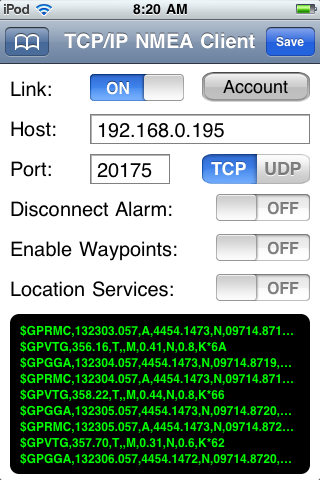
I had a tough time finding many things wrong or missing from this app.  One comment might be that this is a good all around app but may lack detail if you are looking for a detailed marine chart plotter.  It allows you to track many different types of activities but may not replace your dedicated plotter. It would certainly work very well as a back up to most systems.  I did not find any integration of any NMEA 183 or 2000 data either. This may be another reason to hang onto your dedicated chart plotter.

Thursday, November 11, 2010

Marinalife Enhancing the Yachting Lifestyle

Marinalife

Application: iPhone, iPad, iPod Touch
Function: Points of interest, Marinas, restaurants, services
Cost: Free
Rating: ***


Marinalife by EarthNC has put together a nice app to help out the wayward boater.  If you are not familiar with an area pull out your iPhone and fire up this Marinalife app.  It will show you all the Yacht clubs, marinas, marine supply and services you might need in the area. Selecting one of the marina listings brings up a nice entry with a description of their services, a picture, if available, the address, latitude/longitude coordinates and phone number.  Clicking on the Make a Reservation tab takes you to the Marinalife website and allows you to reserve a slip prior to your arrival. It couldn't be easier to find your way in unfamiliar waters.

Features:
  • Extensive list of marina, and related marine services throughout the United States.
  • Searchable by city and state.
  • Listed from closest to furthest away from your location.
  • Uses NOAA maps to show the location of the marina or site you are interested in.
  • The map is scalable with a pinch to zoom in. Use your finger to pan around.
  • The map view show the lat/lon coordinates and heading to the marina.
Pros:

The app does what is say it will do. Search any place and it will give you the marinas and services in that area. I like the Map view, it give the user the exact location, lat/lon and bearing to the marina. The Details tab is very helpful to know what services and accommodations the marina or yacht club might provide.

Cons:

I found it hard to think of anymore details I might want out of this app.  Marinalife did a great job in putting this together. It is easy to use and very informative and best of all, free.

tideApp Worldwide Tidal Data

tideApp

Application: iPhone, iPad, iPod Touch
Function: Nautical tide data
Cost: Free
Rating: ****


If you have ever sailed in Florida, the Bahamas or other shallow areas you know how important tidal information can be.  tideApp is a free application for you iPhone, iPad or iPod Touch that gives you an extensive list of tidal locations not only in the United State but around the world. I was amazed by the number of entries from the US. Hit the Ports tab to view the locations that have data.

Features:
  • Selecting the Near Me soft key list the tidal stations near the user.  This is a nice feature to locate tidal information when you enter a new area. You don't have to know what the stations are named, tideApp already know which one are best for this area.
  • The Port soft key is where the list is divided into US and Non-US stations.
  • Once you have found a tidal station that you want you can save it as a Favorite and show it when you launch the program if you like.
  • Extensive list of US and Non US tidal readings.
  • Internet connection required. 
Pros:
This app is well worth downloading. For free you get worldwide tidal data. The extensive list will have almost any location you sail or boat to.  It displays the data in text and graphical form. I like the favorites selection, it allows you to save your favorite tidal locations so you can return to them easily.

Cons:
It lacks a map of the tidal stations. A map would help the user to see where the data is coming from compared to their location. The application needs an Internet connection to work. No connection, no data. Most of us don't always boat in an area where WiFi or cell service is always available.

Monday, November 8, 2010

gTrax Ship Tracking

gTrax
Application: iPhone, iPad and iPod Touch
Function: Ship tracking
Cost: Free /$5/$10
Rating: ***

Ever wished you could find out the name of that big ship sitting in the harbour? Now you can, with the use of a handy application on your iPhone called gTrax. The app collects the AIS (Automatic Information System) data from ships in your area and displays it on a nice Google map.  AIS is a system that major ships use to identify themselves to others in the area.  

Features:
  • Uses a private network of AIS receivers.
  • Displays ships on Google maps or a list view.
  • Multiple port coverage around the country.
  • Color coded ship icons detail the ships speed and course.
  • Clicking on the vessel shows information about the ship including name, destination, navigation status and job function.
  • Sorting functions allow sort by function.  It will show cargo, tankers, commercial and passenger ferry's and cruise ships.
  • It tracks any ship with an AIS transmitter.
  • gTrax offers updated information for an additional monthly fee. If you want to see updates once every 24 hours it will cost you about $5. To get live streaming data the service will cost you $10.00 per month.
Pros: This basic app is free, that is one plus. The app is very easy to use and works as advertised. The Google maps are functional easy to read.

Cons: The AIS network is not that extensive and spotty in some areas. There are only about nine ports covered in the US. Make sure it covers your area before you download it.  If you need up to the minute information it will cost you $5 per port. It would be best to install an AIS receiver on your boat if you wanted to keep track of ships in real time. Check out the Ship Finder and Ship Tracker apps. They offer up some competition to gTrax with additional features and functionality.

Sunday, November 7, 2010

Navionics Marine Charts

Navionics Marine
Application: iPhone, iPad, iPod Touch
Function: Marine navigation and charting
Cost: $9.99-$24.99
Rating: ***

If your looking for a quality charting system with fewer bells and whistles at a great price then this may be the app for you.  Navionics has been in the digital charting business since 1984 and has been a leader in supplying state of the art charts for navigation.  Navionics has worldwide coverage which is offered by region. The regions are North America, South America, Europe, Africa, Asia and Oceania. These regions are broken into sub regional map sets.  The smaller sets start at $9.99 and the larger set like Marine Europe cost $24.99. I purchased the Caribbean and Central America package for $19.99 and was pleased by the quality and detail in the charts.

Features:
  • Detailed marine charts with points of interest.
  • GPS works through location services on the iPhone, iPad and iPod Touch.
  • GPS worked with the external third party Dual GPS cradle.
  • It has a powerful search function which helps the user find marinas, restaurants, marine repair, boat dealers, tides and currents. 
  • The software can track your position in realtime on the charts.
  • It has the ability to record tracks, routes and waypoints and measure distance.
  • Navionics has the ability to overlay satellite shots from Google or Bing providing an Internet connection is available.
  • It has Facebook and Twitter connectivity.
Pros: Navionics provides state of the art marine charts. The software works right out of the box with no setup required. The price of the sub regions is fairly cheap compared to other charting apps. I thought the overlays of the Google and Bing satellite shots was a plus.

Cons: It would be nice to have inputs for AIS tracking or other instrument types. Navionics does not give access to NOAA charts. There is no caching of the Google or Bing overlays images so an Internet connections is required to display the overlays.

iNavX Marine Navigation Application

iNavX
Application: iPhone, iPad, iPod Touch
Function: Charting and GPS navigation
Cost: $49.99
Rating *****

Whether your a weekend boater or a coastal cruiser you will appreciate this application on your i-thing.  The iPhone and now the iPad have put computing, GPS, charting and navigation in the palm of our hands. The use of these devices and apps as the primary source of navigation on boats is still up for debate.  This app has gone a long way in reaching that goal.

iNavX is in my opinion the most full featured application for charting and tracking your position while underway on the water today. The author has done a nice job displaying the charts and integrating soft keys to access the main menus. iNavX updates the product regularly and they continue to add functionality and new features.

The charting display shows a navionics chart with access to charts, waypoints, tracks, instruments and forecast data through the use of softkeys at the bottom of the screen.
Features:
  • It allows addition of waypoints, routes, tracks and has a full compliment of displayable instruments.
  • iNavX can communicate with your favorite marine navigation software.  Through your WiFi connection, NMEA data can be transmitted over TCP/IP to the iNavX app. Support is included for GPS, AIS and numerous instrument types. 
  • The application works with the third party Dual GPS cradle.
  • I have used GPSGate and Polar Com to transfer GPS and other NMEA data to the application via TCP/IP.
  • The application uses the built in locations services feature of the iPhone, iPad and iTouch.
  • It uses charts that you purchase through X-Traverse. Available charts types are CHS Canada, Navionics Gold, Fish'N'Chip, HotMaps, NV. Verlag, Hilton's Fishing, TRAK Canada lakes fishing charts and Solteknik European waters charts.
  • NOAA charts, similar to your paper charts are free to download with the X-Traverse account.
  • GRIB weather data files can be downloaded through your X-Traverse account.
  • Download it from iTunes and give it a try!
One thing that sets iNavX apart from the other charting apps is that you can connect your ships instruments to the app through TCP/IP.  This feature give you access to all the NMEA data on your boats network.  I have found no other charting app that offers this feature.

Simply add your host IP address and port number and select TCP or UDP. Once the Link button is selected the NMEA data starts scrolling shown in green.

Several different setups can be saved and bookmarked for later use.


Pros: I found it to be full featured and very easy to setup and use. The iNavX website offers help and answers to many FAQ.

Cons: It is a little pricey compared to some other charting apps. Charts need to be purchased separately in addition to the app.

iNavX upgrades to 3.2.5

Rich Ray at iNaX continues to take request for additions to his popular app. He has recently added notification when a waypoint is activated either manually or automatically.  The alert will will display the waypoint name.

One request that I made and I assume others did also was to have the instruments displays in digital format instead of the original speedometer looking gauges. Rich did a good job in this application. Simply go to Preferences and select Instruments. There is now a selection for digital only.

A "More Detail" selection is now provided for the Navionics charts. This will show a list of objects near the location where you tap on the chart.

UDP support has been added in the TCP/IP NMEA Client Setup. Go to preferences and TCP/IP NMEA Client. There is now a setting to toggle between TCP and UDP.

Navionics Region 1XG, 35G 2011 editions.
Great job Rich, keep up the good work. We are all loving iNavX!