
Function: Mobile device AIS display on charts
Rating:*****
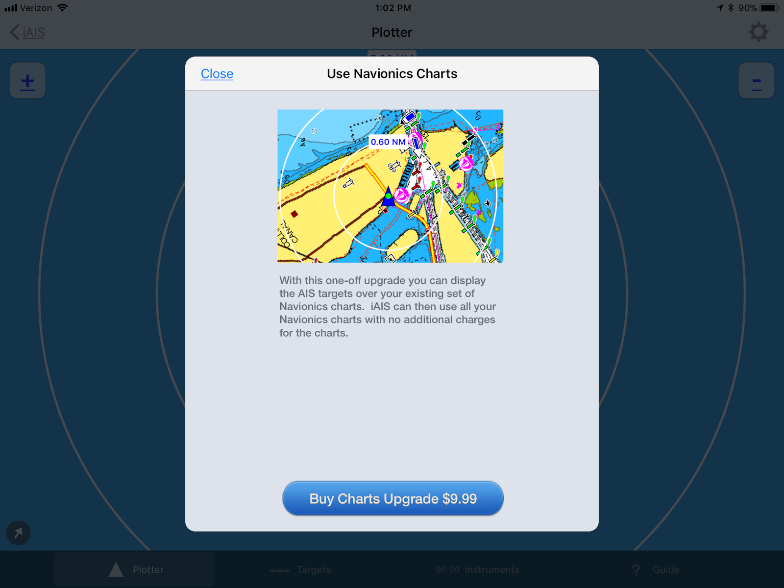
Cost: The iAISs app is free but a $9.99 in app purchase for Navionics chart display.
I am constantly looking for apps that provide value and unique features to share with the boating world. Many of you are familiar with AIS, Automatic Identification Systems. This system allows boaters to identify others yachts around them and get valuable information like speed and course data. This data can then be use to determine if you and the boats around you are on a collision course. Many recreational boats now have AIS B receivers and transponders to add this level of safety.
Digital Yacht is one company that provides AIS systems along with various other marine electronics. I do not work for Digital Yachts and I do not have any affiliation with them. I do like many of the innovative products and apps that they produce.
In their latest news release they have teamed up with Navionics to allow you to use the charts you have already purchased to display AIS data in their iAIS app. No other app that I know of has this capability.
 Digital Yacht had developed the iAIS app several years ago which displays AIS data from many of their AIS products on mobile devices.
They recently teamed up with Navionics to allow users who have already purchased Navionics electronic marine charts to use that subscription on other apps. The Digital Yacht iAIS app is free to download and with an in app purchase of $9.99 a user can then display AIS targets in the app on their Navionics marine charts. You simply log into the iAIS app with your Navionics account and you then have access to your Navionics charts in the iAIS app.
Features:
- Requires a WiFi enabled AIS system already installed on your boat
- Real Time AIS position and target display
- Pan and zoom around the chart
- Tap AIS targets for detailed information
- TCP/IP or UDP protocol
- Simple AIS plotter and NMEA data instrument display
- Used with WiFi AIS receivers and transponders
- SOG, Speed over Ground
- GSA, Position Type
- ALT, Altimeter
- HDG, Heading
- HPE, Horizontal Position Error
- LAT, Latitude
- LON, Longitude
- TCT, Target count
- AWS, Apparent Wind speed
- AWA, Apparent Wind angle
- TWS, True Wind speed
- TWA, True Wind angle
- AWD, Apparent Wind direction
- TWD, True Wind Direction
- GSV, Satellites in view
- FIX, Position mode
- CON, Connection type
- Destination
- Boat type
- Length
- GPS and Wind instrument data display
- In app purchase for use of your existing Navionics charts
- Share your boats position, speed, course over free Internet based AIS apps and websites
 The iAIS app has four main pages, Plotter, Targets, Instruments and Settings.
The Plotter page is where the AIS targets are displayed relative to your position. The targets can then be selected to display more information about their identity, speed and course. This data can then be used to determine if your yacht is on a collision course.
Other soft keys at the bottom of the Plotter page include Targets and Instruments. Each of these pages have Settings pages to adjust the values associated with them.
 The Settings gear icon in the upper right lets you select display modes, icons position, vector sizes and scales.
The option to the Navionics Chart Add-on is also shown here. For $9.99 the in app purchase will allow current Navionics chart owners to use them in the iAIS app to overlay and display the AIS data.
This screen shot shows the Navionics charts with an AIS targets displayed. Selecting the target, in this case the yacht Vantage, shows all the information from that yacht.
The iAIS app can still be used to display AIS targets even if you don't have any Navionics charts. I have purchased Navionics charts for my Navionics Boating app so those charts are available to use with the iAIS app.

The next page is the AIS Targets page, this shows a list of all the AIS targets in the area near your yacht. The range of the AIS targets can be up to 20 miles away in good conditions.
Any of these targets can be selected to show additional information about the other yachts. Data such as course, heading, speed, bearing, call sign, MMSI type of yacht, destination and position.
All of this data can then be used to determine if these targets may be on a collision course with your yacht. Having this data adds a level of safety that has never been possible before AIS.

The third page in the iAIS app is the Instrument display page. The app will display a variety of instrument data if your yachts instruments are connected to a WiFi enabled router.
A wide variety of up to 20 different instrument data types can be displayed including location, wind speed and direction, satellite data, course, speed and position data.
Select the gear icon in the upper right of the display to enable the different instrument and data displays.
 WiFi connectivity can be set up using the TCP/IP icon in the upper left of the Instrument display setup.
The TCP/IP connection will need an IP address and port number of the WiFi router. The UDP connection will need just a port number.
Once you are all set up the instrument data from you yacht will be available on your iPhone or iPad. This will allow you to access and view your ships data from anywhere on your yacht, from your helm, chart table, the head or in the comfort of your berth.
Digital Yacht continues to provide innovative and useful hardware and software application for the geeky connected boater. Let me know what your experience is if you are using the app. Do you find AIS useful as an added safety feature?
~~~ Sail On ~~~ /)
Mark

