Saturday, April 27, 2013

Delorme InReach SE

Wow, I am a gadget lover and this one really caught my attention.  Imagine being able text message from anywhere in the world and provide your location data to your buddies back home. Let them share in your hiking, kayaking or sailing adventures by tracking your GPS path through a web portal.

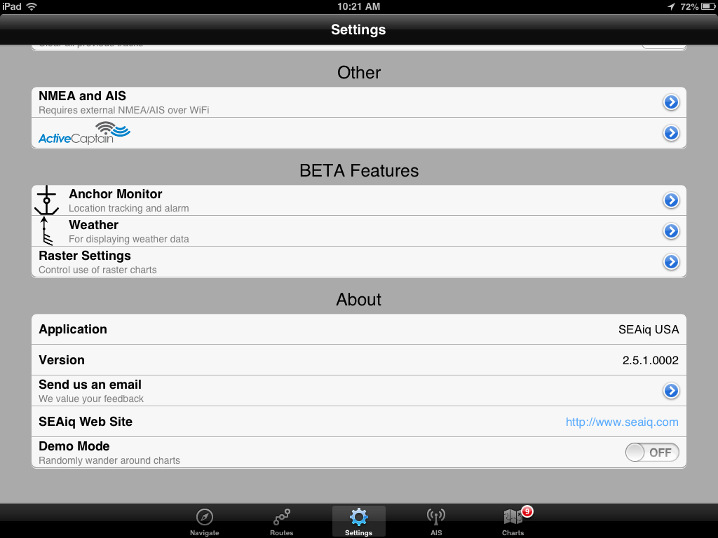
Delorme has created a newer version of their popular satellite communicator. I wrote in a earlier post last September about the Earthmate app and the Delorme Satellite communicator. The older version linked via Bluetooth to an iOS or Android phone through Delorme's Earthmate app.  This unit has the option of being operated stand alone or also linked to your smart phone through the Earthmate app.

How it Works:

The Delorme inReach SE allows your to send and receive text messages from just about anywhere on earth. For you long distance sailors it is a fairly economical way to keep in touch with loved one back home. This new version has a handy color screen and virtual keyboard. It also works with Delorme's Earthmate app on you iPhone, iPad or Android device.  When out of cell phone range, the inReach SE will let you share your travels with family and friends. It has a ping and message feature that lets your loved one keep tabs on you.  It works with the extensive Iridium satellite network which has the best global coverage.  It also has an SOS feature that you can trigger and send preset messages in the event of an emergency.  The inReach SE allows you to have a two-way text conversation with the search and rescue monitoring center until help arrives.  This could prove useful to give search and rescue details about your position or possible injuries.  Every message has confirmation so you will know if you are getting through.  Being able to communicate with the device will give you and your loved ones back home peace of mind. 


The device has a color screen which allows you to access all of its features. Monitor your data use, set up your tracking, check in, set up preset messages, manage contacts, social media and manage the SOS feature.  It can all be done now on the device. The screen allows you to text on the device but you may find it easier to use your smart phone for the texting feature.

The InReach SE has a few more bells and whistles that make it more functional and user friendly. It is also ruggedly constructed to take on the elements. 

Features:
  • Color screen with predictive, virtual keyboard for standalone two-way messaging.
  • GPS accuracy to +/- 5 meters.
  • Waterproof/dust proof (IP67; standard submersion to 1 meter for 30 minutes).
  • Impact-resistant (Mil-STD-810F for vibration/shock).
  • 100 hours of battery life in 10-minute tracking mode with a clear view to the sky.
  • Send and receive free-form, 160-character text messages outside of cell phone range.
  • Trigger an SOS and interact back and forth with GEOS the 24/7 search and rescue center.
  • Turn on tracking to share and view GPS coordinates.
  • Intuitive LED indicator for satellite availability.
  • Audible message notifications.
  • Waterproof, dust proof, and impact-resistant.
  • Post to social media.

  •  Cost of Service:

    To activate your device there is a one-time fee of $19.95.  You will also need to select a subscription plan.  There are several different plans to suite your needs.  They allow you to move to different plans based on your usage.  There is no charge for moving to a higher-priced plan, but there is a $24.95 charge for moving down to a cheaper one.

    The two higher plans provide cheaper messaging and allow unlimited tracking of your position.
                                
    Safety PlanRecreation PlanExpedition Plan
    Annual (12 Months)$9.95 Monthly$24.95 Monthly$49.95 Monthly
    Seasonal (4-month minimum)>N/A$39.95 Monthly$64.95 Monthly
    SOSUnlimitedUnlimitedUnlimited
    Predefined Messages from inReach10 per month shared with MessagesUnlimitedUnlimited
    Messages10 per month shared with Predefined Messages40 per month120 per month
    TrackingNot IncludedUnlimitedUnlimited
    Overage$1.50 per message$0.50 per message$0.25 per message
    $0.25 track


    Web Portal:

    Delorme has set up an Explore web portal which allows you to share your journeys with family and friends.  Set up an account and login.  Use the MapShare feature to include tracking of your GPS position.  All your previous trips, messages and tracks are saved for later viewing.  The Ping feature allows others to see your current position and exchange messages with you. The inReach allows you to set up preset messages that can be quickly sent in case of an emergency.  It allows you to link to many of the social media sites and post your tracking and position data. Firmware updates for your inReach device can also be done through the portal.

    Device Cost:

    The inReach SE is not cheap. It will set you back $299.00. But it is a much more cost effective way to communicate that a full blown satellite phone costing thousands of dollars. It will be available for sale starting in May, 2013.  The original inReach for smart phones runs about $249.

    If your disconnected from the world and traveling in remote places I think this device is a great option to keep in touch.  It provides your family and friends some peace of mind in knowing where you are at and if you are OK.  At any time you can text or check in with them or they can pull up the web and find your exact location and progress of your trip.  On my next ocean passage I plan to give one a try.

    ~~~Sail On~~~ /)
    Mark

    Friday, April 19, 2013

    Thuraya SatSleeve for iPhone


    Application: iPhone 4, 4S
    Function: Satellite/iPhone communications
    Rating:****
    Cost: App Free, sleeve $499.00


    Wow, there is a new way to stay globally connected with you iPhone 4 or 4S. A new device called the SatSleeve turns an ordinary iPhone into a satellite phone.  The present model fits the iPhone 4 and 4S but the iPhone 5 version is reportably in the works. The Thuraya SatSleeve App only lets you set up and use your satellite phone to make voice calls and text messages at this time.  Thuraya also plans to release a SatSleeve with data capability later this summer.

    Features:
    • iPhone 4 and 4s compatible
    • Bluetooth connectivity
    • 12 languages
    • Voice Calls
    • SMS text
    • Battery backup 2400mAh
    • Emergency Call button
    • Coverage in 140 countries, 2/3 of the earth

    Your phone simply inserts into the case and is transformed into a satellite phone.  The app pairs through Bluetooth to connect to the sleeve.  The case contains a satellite antenna and a 2400mAh battery that can also be used to recharge you iPhone.

    The sleeve itself has an SOS button that can be programmed to make an emergency call to whoever you want.  The Thuraya network cover 140 countries around the world but you will notice that North and South America are missing from the coverage map.

    The app shown at left links with your contacts and allows you to make calls or text your friends. The SatSleeve is easily paired to your phone.  Take the back cover off of the SatSleeve and press the pairing button on the bottom.  On your phone go to the Settings menu and turn Bluetooth "ON". The SatSleeve selection should be shown. Once it automatically pairs to your phone you will not have to pair it again.

    For you world travelers this may be the ticket. Total freedom from landlines and spotty cell coverage.  The $499 dollar price tags seems pricey, but compared to a bulky satellite phone costing $600-$1500 it is a nice solution.  A $99.00 per year pre-paid calling plan has rates from 99 cents to $1.49 a minute. It is not cheap but that is the price of world wide service.

    I am bummed out that they do not cover the Americas. Must be a licensing issue or something.  I can only hope that it will be offered in our area at sometime in the future.


    Sunday, April 7, 2013

    SEAiq 2.5 Revision


    Application: iPhone 3,4,5, iPad, iPod Touch iOS 6.0
    Function: Marine GPS Navigation and Charting
    Rating: *****
    Cost: SEAiq USA $9.99, Free version, SEAiq Open $19.99

    Mark Hayden, the author of the SEAiq series of apps, has been very busy lately. He has not only sailed more than 15,000 miles this past year but also has made many valuable additions to his SEAiq charting app.  I originally reviewed the SEAiq USA app back in April of 2012.

    Mark and his growing family arrived back at their boat in Australia with an added crew member this year.  Their son joined them as they spent many months exploring the coasts of Australia and eventually moving on to Southeast Asia.  Concerns about pirates forced them to cross the Indian Ocean and onto South Africa.  The last leg of their trip was from South Africa to Cape Verde where the boat will remain until baby number 2 arrives shortly.  They plan to continue their adventures in the Mediterranean. Congratulations Mark and Dana!

    You can follow all of their travels on their Northfork blog.

    Mark's many ocean miles have given him a unique perspective on what features are valuable for crossing oceans as well as coastal cruising.  He happens to be an accomplished sailor and a very talented programmer.  This combination has produced one of the best charting apps on the market today.

    The latest additions to SEAiq have added more functionality to the already feature rich app that is becoming the Go-To-App by many boating enthusiasts and harbor pilots. The variety of features and the versatility to display just about any type of chart make it a must have app.

    Features:
    • NOAA ENC Vector
    • NOAA Raster charts 
    • US Army Corps of Engineers vector chart of inland waterways
    • For SEAiq Open formats include, KAP and BSB formats, S-57, S-63, Inland-ENC, CM93, and KAP/BSB plus home-made charts generated from satellite imagery
    • Offline use of charts
    • Night time color modes
    • ActiveCaptain points of interest
    • On screen instrument display
    • iPad vertical instrument display 
    • LAT: Latitude, LON: Longitude, ACC: Horizontal Accuracy of current GPS fix, COG: Course Over Ground, SOG: Speed Over Ground, BTW: Bearing To Waypoint, DTW: Distance To Waypoint,VMG: Vector Made Good
    • English and metric units
    • Import/Export
    • Detailed Vector chart information
    • Waypoints creation and edit
    • Route creation and edit
    • Tracking
    • Smooth chart quilting
    • World chart view
    • Multi-touch gestures, pan and zoom 
    • NMEA WiFi instrument and AIS data
    • AIS display
    • Weather Grib downloads from the Internet or Saildocs via Sailmail
    • Wind, pressure isobars
    • Anchor Alarm
    • 7 Day evaluation period
    • Drag and drop Variable Range Markers
    • Drag and drop Electronic Bearing Lines
    Mark continues to add many useful features to an already great app. He makes it easy for you to try the app with his Free version. All the features of the app are available for 7 days.  The premium features are colored a light magenta so you know what you get when you purchase the upgrade.

    The premium features will no longer be available after the 7 day trial period.  They do allow you to un-install the app and reinstall it for another 7 days if needed.


    Chart Types:

    SEAiq has a very wide range of charts that can be displayed.  Unlike most charting apps many of the charts can be downloaded and updated for free.  For SEAiq USA and SEAiq Free, both raster and vector charts and updates can be downloaded free from NOAA within the app.  Vector charts for inland waterways published by US Army Corps of Engineers are now available too. The app allows you to switch back and forth between displaying the raster or vector types of charts.  The Raster setting in the settings menu will switch the viewed charts between Vector and Raster.


    For the SEAiq OPEN version, you can load charts in the KAP and BSB formats. SEAiq OPEN now supports formats including S-57, S-63, Inland-ENC, CM93, and KAP/BSB.  Many of these can be downloaded from the Internet and imported using the Open In feature. Support also includes home-made charts generated from satellite imagery.  This is useful for areas that do not have good chart coverage. The OPEN version is free to download and with an in app purchase of $19.99 it will upgrade to the premium version with all the features.  No other app allows you to download and use so many different chart types.

    Mark provides links to many free S-57 chart sources within the app's help screen. (See below). Help for downloading other types of charts is also explained nicely within the app.

    NOAA provides high quality charts of the USA and territorial waters:
    http://www.charts.noaa.gov/ENCs

    The US Army Corps of Engineers provides charts of some inland waterways in the USA (in both S-57 and Inland ENC formats):
    http://www.tec.army.mil/echarts/E_download.html

    Numerous charts of inland waterways in Europe. Below are some of the links. Note that these links change from time to time:
    Austria: http://www.doris.bmvit.gv.at/fileadmin/group_upload/8/ECDIS_Download/Edition_5.zip
    Belgium: http://ris.vlaanderen.be/IENC/
    Czech Republic: http://193.86.76.109/lpm/maps_S57.asp?lang=en
    Germany: http://www.elwis.de/RIS-Telematik/Inland-ENC-der-WSV/IENC-Dateien/index.php.html
    Netherlands: http://www.vaarweginformatie.nl/fdd/main/infra/enc
    Romania: http://www.afdj.ro/electronic_map.html
    Serbia: http://www.plovput.rs/elektronske-navigacione-karte
    South China Sea (requires registration): http://scsenc.eahc.asia

    Status Bar:

    Another new addition to the app is the Vertical Status Bar.  This is available for iPad versions when in landscape mode.  When you rotate the app into landscape mode the status bar will move from the top of the display to the side of the display.   The data is now organized into more logical groups for display.  The GPS position and senor data is separated and shown on top.  The SOG and COG readings are displayed using a bigger font which makes them stand out and easier to read.

    Context-sensitive information is also displayed when certain features are turned on so you only see the data when it is useful to you.  When the anchor alarm in enabled, the information about relative position of the anchor is displayed. When AIS is being used, information for the most recently selected target is displayed.


    VRL/EBL:

    Variable Range Markers and Electronic Bearing Lines are some new tools added for measuring distance and bearing.  These can be added to you chart by simply double tapping at any point and making a selection.  The VRM tool allows you to specify a distance around your present location or a point. A circle is then displayed at that radius.

    EBL can be made from any point on your chart to another point or location.  It will display the bearing and distance between the two points.  This feature is nice to quickly find distance and bearing from your own-ship or even to an AIS target. These can be dragged and dropped onto or off of a vessel.

     
    Weather:

    One of the latest additions to SEAiq is the weather data including Wind, Pressure/Isobar data.  It has the ability to download this data automatically from the National Weather Service. An Internet connection is required. This latest release adds the pressure/isobar lines.  The weather data can also be downloaded manually while underway via SailMail/SailDocs using your SSB.  Additional weather data is planned for future releases.  The settings menu in the Weather sections lets you control what data you want to see and how it is downloaded.


    SEAiq continues to add many functional and desired features for mariners.  The app has matured over the past year to become a full featured marine charting app. The latest features including Active  Captain POI, additional chart types, import/export, weather, instrument data, EBL, VRM, AIS, anchor alarm, and NMEA WiFi capability make it a must have for you iPad.   

    ~~~ Sail On ~~~ /)
    Mark