 The most popular post on my blog last year was, iNavX. It was the most searched for and read post during 2011. It is not hard to figure out why, iNavX was one of the first marine navigation apps out there for the iPhone and the iPad.
 iNavX continues to to update the app and make needed improvements to take advantage of all the iPad's capabilities. I plan on writing a series of articles in the next few weeks to showcase this great app. I originally wrote a iNavX post over a year ago and much has changed with the app since then.
Some may shy away from the app because it will cost you $49.99. Don't let that stop you from buying it if you are a serious marine navigation nut like me. It is much more than just a charting app as we will find out. Some other added features you won't find in other apps are AIS, NMEA 0183 and 2000 data, anchor alarm and auto pilot control.
Lets re-visit some of the features of this great app:
- All NOAA RNC marine charts free to download.
- Large chart store X-Traverse with a variety of charts. Charts include CHS Canada charts, Navionics Gold charts, Fish'N'Chip charts, HotMaps, NV. Verlag charts, Hilton's Fishing charts, TRAK Canada lakes fishing maps and Solteknik European waters charts.
- Map and satellite overlays.
- Full line of instruments to display in digital or analog style.
- Instruments types for location services, NMEA 0183 and NMEA 2000.
- WiFi capabilities receive and send data over TCP/IP.
- Ability to email position.
- Create waypoints and routes. Import and export waypoints and routes including KML (Google Earth) and GPX formats.
- Export tracks to email or Facebook via X-traverse account.
- Track Log recording.
- Ability to measure bearing and distance.
- Weather forecast Grib files and tides.
- On screen compass and instrument bar.
- Multi-touch gesture controls of screens.
Let get started using this great app.
1. First download the app from the iTunes Store. You will need an iTunes account to make the purchase. I would suggest downloading it to your iPad if you have one. The larger form factor of the iPad is great for viewing the charts. The iNavX app will work on the iPad, iPhone or iPod Touch with iOS 4.2 or later.
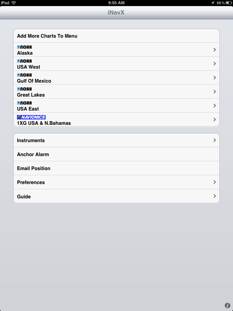
2. Downloading Charts is fairly easy. iNavX allows you access to all the NOAA RNC charts for free. These are the most common charts used for coastal navigation. To download charts select a Chart Region to download. The NOAA charts for Alaska, USA West, Gulf of Mexico, Great Lakes and USA East are available.

This is the NOAA USA East chart list. Simply select one of the charts that you wish to download. You will then be asked to download the chart or download all "USA East".
If you want all the charts, go for the download all. If you are just interested in the one chart you selected, select "Yes".
The charts that you have downloaded will now show up in bold.
There are three indications at the top of the chart display.
There are three indications at the top of the chart display.
 The magnifying glass will allow you to search by number or name. The Triangle will show charts that intersect with your position. The Clock will show you the most recently opened charts.
If you want additional charts other than the free NOAA charts you can purchase these through X-Traverse. This process is complicated, so follow below.
You will need an X-Traverse account to purchase and access your charts. This account will cost you $10.00 per year and allows you access to your charts through the iNavX app. Access to Grib weather files and transfer of waypoints and tracks can also be done through your account.
 Once you have your X-Traverse account you can then purchase additional charts. Make sure you purchase the iPad charts for download. They offer a wide range of Navionics, CHS Canadian Charts, Fish"N"Chips, HotMaps, NV Verlag and Hilton fishing charts.
To access and download your purchased charts in your iNavX app you need to add your X-Traverse account information to the app. Go to "Preferences" and select "X-Traverse Account". This is where you will add your email and password for your account.
Next select "Show Account Information" this will retrieve your account info showing you what products you have activated for use by the iNavX app.
You will next need to go back to the Charts list and select "Add More Charts to Menu". The next menu should show you the list of charts. The charts you purchased should show up as bolded. I purchased Navionics Gold Marine Charts 2011. Select this and another display will show the charts in that package. Turn "ON" the charts you purchased.
Go back to the iNavX menu and select the chart you turned on to view you charts. Select your chart title and download you your iPad.
My next post will cover the charts display and navigation screen features for iNavX.
I am extremely impressed with your writing skills as well as with the layout on your weblog. Is this a paid theme or did you customize it yourself? Either way keep up the excellent quality writing, it’s rare to see a nice blog like this one these days..
ReplyDeletePfeilring Cuticle Scissors, Nickel Plated, 9cm, .77-Ounce Package
Thanks for stopping by and your kind comments. My English teacher would be proud.
DeleteThis is a standard layout customized with some of my graphics and style. Stop back soon!
~~~SailOn~~~
Mark
This comment has been removed by a blog administrator.
ReplyDeleteMy problem is that I cannot seem to download NOAA raster Region 10- USVI and Puerto Rico from my iNavX app or from my Fugawi X-Traverse account. It's just not an option, much like in your example above. Is there a way to import the chart for use in the app? I've downloaded the RNC files from Noaa...
ReplyDeleteThanks!
Thomas
If the USA East NOAA charts do not show up in the list, tap Add More Charts to Menu. Select NOAA US Marine Raster Charts. Turn on USA East. Hit Save.
ReplyDeleteThe Puerto Rico charts are available in the app under NOAA USA East. They are all the way at the bottom of the list. I just downloaded chart 25671_1 which is West Coast of Puerto Rico. The USVI are listed there also.
Hope that helps, stop back soon!
Mark
Hi, If I already own other raster charts used in windows could I not copy the files and use them on the ipad. Is there a clear file directory where the charts are stored and used by the app that could be taken or added the BSB and KAP files?
ReplyDeleteAnonymous,
ReplyDeleteI do not think you can use the raster charts on your computer. I am not sure what file structure iNavX uses to store the files. I have not seen any discussion about this either.
It is kind of a pain to get an XTraverse account and pay the $10 bucks, but I think that is the only way to get the charts.
Mark
I've been testing this app before my boat purchase. When I'm in chart mode and scrolling to the end of a chart, is there a good way to load the next chart in the route?
ReplyDeleteLike google maps are not segmented by charts. Seems impractical to have the functionality of digital and be limiting scroll to the chart you are on.
How are you going from chart to chart?
I don't know if while you are underway it automatically changes or not since I haven't been able to test it.
Basically I'm creating routes on land.
Thanks
Anonymous,
ReplyDeleteIf you are using just the free NOAA raster charts the app does not automatically go from chart to chart. This is called chart quilting.
If you buy the Navionics charts through an X-Traverse account the vector charts will automatically show the entire region that you purchased without having to select another chart. The vector charts are very nice to read and navigate by. I would suggest buying the region that you plan to sail in most of the time.
I purchased the 1XG USA & N. Bahamas set. It includes the entire US, Great Lakes and the Bahamas.
Mark
Mark,
ReplyDeleteI have an ipad 2 without true gps. If I add the Bad Elf gps device will it work fine with inavx?
Knighthawke2k
DUH! I found it! I need to learn to read first and ask questions later.
ReplyDeleteSorry bout that.
Knighthawke2k
Mark does this app work on 3g?
ReplyDeleteIt works on 3G and without any internet connections also. Charts are downloaded to the device so it will work offline anywhere in the world. All you need is a GPS which most iPhones and 3&4G iPads have.
DeleteMark
Do you prefer it over the Garmin Bluechart? Some of the reviews point out that you can't navigate and get depth and wind on the inavx,i find that hard to be true after reading your reviews.
DeleteTim
Tim
DeleteiNavX does allows you to navigate to waypoints and routes using the GOTO feature. It provides bearing, distance and cross track error as you navigate to the desired waypoint or route. It can even control your autopilot which Garmin BCM cannot. Check out this video on YouTube. http://www.youtube.com/watch?v=J7POAPsK-SY
The iNavX instrument package does allow you to display a vast array of NMEA instruments. More than any other app. These can be sent to the iPhone or iPad using TCP/IP/UDP over WiFi. Garmin does not allow display of WiFi data unless your connected to a Garmin Chartplotter.
Garmin BCM falls short of being a full blown navigation package. It only displays your position on the charts. It allows you to create waypoints and routes but it does not navigate to the waypoints and routes like iNavX does. It is more of a planning app.
Good Luck
Mark
This comment has been removed by a blog administrator.
ReplyDeleteHi your blog is very useful. I was wondering for autoroute application in south florida what do u recommend. Thx
ReplyDeleteSalloum,
DeleteiNavX has a great routing function. It is easy to create routes by selecting waypoints. You can then follow them with autopilot control if needed.
Navionics HD USA for iPad is about the same price with less functionality. It does have an autorouting feature that can be purchased for an additional 4.99.
Hope this helps.
Mark
Hi
ReplyDeleteI live on the west coast in Vancouver bc canada so I need Canadas charts. It looks to me like I have to pay 10 dollars per year for the xtraverse acct and 169 dollars per year for the chart I need??
The Canada and SE Alaska charts for the iPad are $54.99.
Deletehttps://www.x-traverse.com/product/TD-NAV-2XG-IP-2011.
You will need an xTraverse account to download the charts. The account allows you to save waypoints and routes and backup your files.
Once you download the charts to your device they are yours. No need to buy again.
Mark
Three years ago I purchased Canadian charts that now reside on my Mac Pro laptop. I also have the CDs. How can I transfer these to my Ipad/Inav?
ReplyDeleteMike,
DeleteiNavX will not work with your purchased charts. You have to set up an account with xTraverse.com and purchase charts through this website. There is no other way to get charts into iNavX.
SEAiq Open is an app that will accept a wide range of chart types including S-57, S-63, CM93, iENC, BSB, and KAP. This developer allows charts to be uploaded and used in the app. Check out the SEAiq Open app in iTunes. https://itunes.apple.com/us/app/seaiq-open/id529514298?mt=8
Mark
I am wondering, do I have to get an x-tracverse account or is that only of I want more charts?
ReplyDeleteYes, you will have to get an xTraverse account. iNavx does not allow downloading of chart any other way. The NOAA raster charts are free to download. You will have to buy all other chart sets.
DeleteHave fun!
I was wondering if the iNavx will work without any internet connection? If yes how? Will the marine gps be accurate?
ReplyDeleteAlex,
DeleteYes iNavx works just fine without an Internet connection. It was designed for offline use. Your device must have a GPS in it to work. Most iPhones and iPads with cellular service have a GPS in them. If your iPad does not have cellular capability you will need a separate Bluetooth GPS device to allow GPS tracking to work.
Mark
The weather and tides features do require an Internet connection to download data. All other features work independent of the Internet.
Mark, thank you for your review. About how big in MB/GB is the set of NOAA USA West or the CHS for east/west coast Vancouver Island or the Navionics 2XG you referenced above? I'm new to the iPad and don't want to overfill it.
ReplyDeleteI have downloaded the free NOAA USA West and now understand, because I am only interested in the Puget Sound area (and Vancouver Island, BC), that I probably don't need many of the charts. How do I delete them?
If I get the Navionics set, it will give me seamless (quilted) movement and I won't need any of those NOAA charts (for the San Juans and Puget Sound south of there) at all - right?
What would be the visual difference between what I see with the Navionics vs what I would see using the CHS charts? Or for that matter, Navionics vs NOAA?
Basically it would cost about $510 for a CHS set that covers the same area as the Navionics set. So I'm wondering what I'm giving up - what would I be missing by (aside from spending a boatload of money) if I didn't get the CHS charts?
Thank you for your time if you answer this. I know it isn't iNavX specifically, but I have purchased the app and will be using it.
It looks like X-Traverse as dropped that $10 fee; at least for now.
Paul
Paul,
DeleteGreat to hear from you! I am not familiar with CHS charts but they seem very overpriced to me. I would go with the Navionics set. I have them for the U.S. and the Bahamas. Very detailed, colorful and full of information. You don't need to down load the full set all at once. You can just download the charts you need for your area.
Full chart sets are 100 to 400 Mb. Individual charts are 10to20 Mbs.
Go with the Navionics, Garmin uses them too so they must be good!
Mark
Paul --
DeleteI just renewed my CHS charts for Vancouver -- the CHS RM-PAC02 set covers all of Vancouver Island East, and was $139.95 (Regular price is $149.95.) It's not necessary to buy the $500 set for the Gulf Islands & Desolation Sound. I also noticed that the $10 x-Traverse fee seemed to be gone.
After using the NOAA raster charts for awhile, I also bought the Navionics Gold USA charts, which covers Puget Sound and the San Juan Islands, plus a lot of other areas. Wish I'd done it 3 years ago -- amazing difference with the vector charts!
And, Mark, great site!
Cheers, Vic Owen
Kirkland, WA
An update to yesterday's post...
DeleteI also bought the Navionics 2XG for Canada, to get the Vancouver Island area. Much more readable than the CHS charts. And, I didn't realize it until I downloaded the Canada Navionics charts that they cover all of Puget Sound & the San Juans, as well -- I didn't need the 1XG USA pack for the PNW. My bad for not digging a little deeper!
Vic
I don't see the Compass rose on the charts. Yet, the courses are in True and need to add or subtract for variation since the language of the boat's compass is in magnetic. Your reply please.
ReplyDeleteDavid,
DeleteI am not sure what charts you are using in iNavX. There is a setting that can change your bearing readings to Magnetic.
Select Instruments then select the gear/settings icon. The True Bearing setting will allow you to switch between True and Magnetic settings. When the selection in on the True bearing will be shown. When the setting is off the Magnetic bearing will be show.
There is also an option right below the True Bearings setting call compass deviation. I you know the deviation for your area you could add it manually here.
Thanks for the question and spread the word about my blog to all your boating friends. Appreciate your support.
Mark
Mark, I hope you can help as I too am a fan of i-navx. My issue is how to manage the power as the ipad2 seems pretty hungry. At night I would like to leave i-navx running in the background so the anchor alarm and tracking functions continue to function but the screen is turned off. If I use the sleep button on the side the whole application seems to stop working. Do you have any suggestions? Thanks, Graham
DeleteGraham,
DeleteI would try a few things. Go into Settings on your iPad and look for the iNavX app icon. Here select Location and set to Always. This will enable the GPS location services even if the app is running in the back ground.
I found this on the iNavX website,
Anchor Alarm
The "Anchor Alarm" will trigger (audible and visual alert) if enabled and the position changes more then the selected distance. "Test" can be selected to simulate the alarm. In order for the Anchor Alarm to work, iNavX must be active (i.e. running) and have a good position fix (as indicated by "HPE:" in the Instruments view). The Anchor Alarm perimeter is plotted on the chart. "AAD:" in the Instruments view will display the amount of drift. Use the "Anchor" button to set the approximate location of the anchor relative to your position. Make sure the Anchor Alarm perimeter distance is greater then the distance to the anchor, otherwise the alarm will trigger immediately after enabling. The "Scope" button can be used to get a recommended amount of anchor rode to deploy.
Anchor Alarm audio will repeat until "Cancel" button is selected or the Alarm view is dismissed with "Save" button. To make sure the audio alert can be heard, confirm: The "Mute" button is not turned on AND The Volume slider in the device "Settings" "General" "Sounds" "Ringer and Alerts" is at maximum level. "Change with Buttons" can be enabled to allow the buttons on the side of the device to control the volume level.
There are other Anchor alarm apps out there that may suit your needs better. Check out DragQueen Anchor Alarm and Anchor are two that have more features. You will most likely have to keep your iPad or iPhone plugged in to keep from running your battery down.
The Anchor app did alarm when the screen was powered down. I think that is what you were looking for.
Mark
I just purchased iNavX and downloaded the NOAA Gulf of Mexico chart but can't get coastal/intracoastal waterways depth nor navigational aids/markers...how can I or do I need to get different charts?...I apologize for the simplistic question but I just can't figure it out...
ReplyDeleteRafael,
DeleteIs sound like you bought charts on x-Traverse but can't see them on your device. Read the last section of the post I did above. You have to login with your x-Traverse account in the iNavX app and enable the charts you want to see. Have you done this? Is so you should be able to see the charts you selected. As you zoom in the makers and depths should show up. When you are zoomed out the chart should have some red outlined boxes on it to show you the charts for the Gulf. If you don't see the red outlined boxed you have not enable any charts to view.
Mark
Sorry to be such a dolt. I'm ready to download INavx but am still foggy on downloading charts. Can I go to NOAA for the free charts or do I go thru x-traverse? Can I price things before I open an account? In your estimation is it to go with the paid charts vs NOAA for quality/quilting? Hal
ReplyDeleteHal,
DeleteNo, charts for iNavX can only be downloaded through the xTraverse site. I did a post about the NOAA charts a while back,(http://i-marineapps.blogspot.com/2014/05/ inavx-adds-noaa-raster-chart-quilting.html). At that time they were free. It now looks like they cost $9.99(https://x-traverse.com/product/TT-TILE-NOAA-RNC) This link takes you to the page to buy the charts. There is a good description of how to download the charts there also.
Good luck.
Mark
Hal,
DeleteThere are many good tips, tricks, question and comment on this message board. The author of the software GPXNavX is pretty active and will answer most questions.
Mark
Here is the link to the message board.
Deletehttp://www.macsailing.net/fbb/showforum.php?fid/23/
Mark, I mistakenly downloaded the Alaska charts not realizing they were not quilted. Now I have hundreds of charts I want to delete but when I hit delete the title goes gray but are not gone. I want to get the quilted charts. but I'd rather not hold all those charts in memory. Any solutions? Hal Smith Thanks, Hal Smith.
ReplyDeleteHal,
DeleteCheck this article out on MacSailing. Turning off a region does not delete the charts. Follow the instruction on the link.
http://www.macsailing.net/fbb/showtopic.php?tid/1156/
Good luck
Mark
Hello I am in northern Haiti and just downloaded the app for my 6plus , what chart do I need to download for here?
ReplyDeleteJoel,
DeleteGreat to hear from you! Charts can be downloaded from the xTraverse website for iNavX on the iPhone. Check out this link to the Caribbean, Central and South America.
https://www.x-traverse.com/product/TD-NAV-3XG-MB.
Best of Luck! Sign up to become a follower and share the site with your friends.
Sail On!
Mark
Hello Mark,
ReplyDeleteAfter the last update of iNavx I am no longer able to find the "Update" button that enable me to update just the Charts that I have selected. Now it appears that my choices are limited to update just 1 chart at the time OR all the charts in the region.
Where is the Update button hiding?
Thanks in advance...
Claus,
DeleteThanks for the question. I will try to answer it. If not email the developer and they will help you out. ios-support@inavx.com
Updating charts can be done for individual charts or chart sets. I assume you are talking about Navionics charts sets and not the NOAA charts. From the iNavX charts menu select the chart set you want to update. A list of all your charts will then show up. The top selection says Update Chart List, this will delete all the charts on you device and then you will need to download new charts. If your subscription has run out you will need to update that to activate your charts with the new version
You can also select one chart to update. This will delete the chart and download the new chart.
If that does not work email the iNavX developers they will surely be glad to help you out.
Mark
Thank you Mark for the quick reply.
DeleteI guess I was not very clear in my post, so this is what I sent to ios-support@inavx.com:
"
After the last update of iNavx I am no longer able to find the "Update" button that used to enable me to update just the NOAA Charts that I have selected. Now it appears that my choices are limited to update just one chart at the time OR all the charts in the Region I have selected (USA West)
I have an X-Traverse Account and I am trying to update from the NOAA US Marine Raster Chart menu. The only option is the "Automatically Detect Available Charts" which lets me add other regions that I do not use.
So - if for example I only use a subset of the charts in the USA West Region how do I update them easily without getting the whole region. I know I can go thru the long list one by one, but surely there must be an easier way. Where is the update button?
Thanks in advance...
~~~~~~~~~~~~~~~~~~~~~ _/) ~~~~~~~~~~~~~~~~~~~~~
Claus,
DeleteI do not use the NOAA charts and was not aware the new version took away this feature. Thanks for letting us know. I hope the iNavX developers will help you out. Let me know if they fix your issue.
Mark
This comment has been removed by a blog administrator.
ReplyDelete