Sunday, January 30, 2011

Best Free Weather Apps for the iPhone

Weather is extremely important to sailors, boaters and weekend yacht enthusiast.  Knowing what the conditions are is important before you head out on the water.  I recently counted almost 3000 weather related app in the iTunes App Store. Sorting out which ones are the best depends on the boaters need.

There is a ton of weather data out there for free so don't pay for weather or a weather app for your iPhone or smartphone.  My criteria for a good weather app would have to include forecast for temp and wind, wave and sea state conditions and radar and satellite maps.  Of course you have to have a cell or Internet connection to get the most up to date information. Some of my favorites are listed below.

Weather Channel App (free)

The Weather Channel is hard to beat. They have a great app that has all the data you will need. We have all come to know and love the Weather Channel girls.  The have been on cable TV for as long as most of us can remember.

Featured Data:

Actual temp
Wind
Humidity
Dew Point
UV index
Visibility
Sunrise
Sunset
hourly, 36 hour and 10 day forecasts
Severe warnings
Radar Map
Video forecasts


Weather Eye App (free)

Weather Eye is another favorite that presents all the weather data in a similar format as the Weather Channel.  You can also add multiple cities or locations to monitor.

Featured Data:

Actual Temp
Wind
Humidity
Pressure
Sunrise
Sunset
Visibility
Precipitation
Hourly
24 hour forecast
5 Day forecast
Scrolling banner with severe warnings
Radar


Weather+ HD App (free)

Weather+ HD displays all information on one display which makes it more for a desktop display.  The font for the forecast data is kind of small otherwise a nice looking app.

Featured Data:

Current Temp
Current Conditions
Hourly forecast
Five day forecast
Humidity
Precipitation
Wind
Direction
Pressure
Visibility


National Weather Service (free)

This is not an app but these are screen shots from the NWS site (http://forecast.weather.gov/) accessed through the Safari browser.  You can make a home screen icon of your location and add it for easy access by going to the site, selecting the arrow button on the bottom of the screen, instead of adding a bookmark, select add to home screen instead.  This will create a icon shortcut on your home screen of your iPhone, iPad or iPod touch. The national weather service is my main source for weather.  They provide free weather and are the source for most other weather site on the Internet.

Featured Data:

Weather at a Glance
Temperature
Weather Conditions
Humidity
Wind Speed
Dew point
Visibility
Radar
Satellite
7 Day forecast
Precipitation
Wave heights
Forecast Discussion
Marine Forecast
Hurricanes
Severe Weather


Weather Bug App (free)

This app is popular and has most of the data you will need while out boating. It is divided into several different screens for viewing current data, forecast data, weather maps, video forecasts and weather cameras.

Featured Data:

Temperature
Hi/lows
Wind
Wind direction
Humidity
Dew Point
Daily forecasts
7 day forecasts
Map overlays for radar, satellite, temperature, heat index, wind chill, dew point, World satellite


Saturday, January 29, 2011

eSeaCharts US Marine Charts

Application: iPhone, iPad, iPod Touch
Function: Marine Charts and Navigation
Cost: $9.99
Rating: *

More charting apps keep popping up in the App Store every week.  There seem to be no end to developers trying to gain a share of the Marine App market.  Another app for use with NOAA charts is eSeaCharts.  At first glance it seriously lacks the charts, features and functionality to be a front runner.

Features:

The app uses NOAA raster charts which have the original look of the old paper charts.  Many people don't know that they can download the NOAA charts for free both the raster and vector versions from the NOAA website.  This app uses the latest raster version of the charts and displays them for you in the app.

The app allow you to use the charts to plot and track your real time position. There are four soft keys at the bottom of the app. Navigation, Waypoints, Charts and Settings.

The navigation feature allows the user to view the real time position on the chart as your boat moves along. You can select waypoint and navigate to them.  The waypoint feature is basic but is functional. It allows the user to create waypoints and save them for later use.  It has a navigate to feature so you can go back to your favorite spot or fishing hole.  The charts page allows you to download the latest versions of the NOAA charts.  The charts are updated weekly to keep the user up to date.

I found the app to be very basic and spartan in its features. The price tag of $10 seems high for the lack of features and functionality. Other apps in this price range offer many more features.  Review my other post for iSailor, Navionics or Navimatics for apps similar to this but with more useful features.  If you want the best app out there spend the money on iNavX.  Check out all the post to make sure you buy the app that supports charts for your area and includes the features you need.

The eSeaCharts website is also brief in its support and documentation.  Some commenters in the forums were complaining about the lack of charts and features.

The app falls short of being a great app and is overpriced in my opinion.

Saturday, January 22, 2011

The Perfect Marine Navigation App

Application: iPhone, iPad, iPod Touch
Function: Marine Navigation and the works
Cost:  Free would be nice
Rating: *****


The Perfect Marine Navigation app, does it exist or is it still something of your imagination? I have reviewed quite a few Marine navigation and charting apps the past few months. Some are good, some are bad and some leave a lot to be desired. Check out my Top 10 Charting App recommendations

If  you could design the perfect app your self what features would it have? What maps would it have? Well, let take a look at a laundry list of features that I would like to see in the perfect app and you all can hopefully weigh in with your comments too.

Charts
Most people who use these apps are looking for high end charts that show enough detail to use for meaningful navigation. Many apps utilize the NOAA charts because they are free and easily downloaded. The higher end apps utilize chart sets that contain additional detail and points of interest. If you use the NOAA charts as a base set of charts it would be nice to be able to download additional charts sets from a supplier for a reasonable price. Chart set should be purchased by regions so only the needed charts are downloaded and kept on the device

The charts have to be down loadable to and reside on the device. While boating, a cell or network signal may not always be available, so the charts have to reside on the device to make it usable. Some apps attempt to download charts as you use them. If your offshore this would not work.

GPS
The application must integrate with a GPS signal or external device to obtain GPS coordinates.  Most devices have a GPS signal through WiFi or cell phone triangulation or an onboard GPS chip.  GPS is the engine that makes these locational based app so powerful and allow real time tracking of your position. The iPhone, iPad and iPod touch have what Apple calls locational based services. This is how they provide a location to the apps that reside on the device.

It would be nice to have access to a GPS signal from outside the device. In my blog I have a whole page devoted to GPS devices to power your iThing.  If you have an iPhone or iPad with 3G an assisted GPS chip should be onboard. I have been experimenting with an iPod touch and it does not have a GPS chip in the device so it has been my search for a way to give GPS functionality to the device while I am away from a WiFi signal.  I have found some apps that allow access to a GPS signal and other NMEA data through TCP/IP, Bluetooth or the serial port. These are all great communication protocols that allow for exchange of data. 

Instruments
On board your boat there are probably a host of instrument running either NMEA 0183 or 2000 protocols. This data includes, speed, bearing, wind speed, wind angle, coarse over ground, depth, distance to waypoint, heading magnetic or true, speed over ground, water temp and cross track error to name a few.

How do we get this additional NMEA data to your mobile device?  TCP/IP allows communication between devices that reside on the same network.   My dream app would have the ability to take data from the ships onboard navigation systems and display it on my devices.  This would allow me to walk around my yacht being able to quickly browse any instrument from my mobile device.

Waypoints
Waypoints are the basic building blocks of marine navigation. These points mark where we want to go or places that we want to navigate back to at some later time.  The app would have to have the ability to save or create a waypoint with latitude and longitude coordinates. The ability to name the waypoint whatever the user wants to name it should be a basic feature.  Waypoints should be able to be stored on the device and have the ability to download or upload the waypoint to a computer or the Internet. It would be nice to have different markers icons to choose from for display on the maps.

Routes
Routing is also a basic function that should be provided.  Routes are simply a set of waypoints that have been selected and strung together to make a path for the app to follow.  Naming and saving Routes should also be done within the app.  Uploading and downloading of routes to or from a computer or the Internet would also be a nice feature.

Tracking
Tracking is a great feature that records the coarse you have taken while navigating.  It is like creating electronic bread crums to find your way back to a place. The app should allow the user to either turn on or off the tracking feature.  Tracks should be recorded on the device and allow the renaming of the track. Import and export features to a computer of the Internet would also be usable.

Overlays
Our friends at Google and Microsoft have both created marvelous satellite overlays, Bing and Google maps which have brought a new perspective to navigating.  The ability to overlay different map types on the charts is not a necessity but it does provide additional functionality to marine charts and navigation.  The problems have been that these overlays are only available while connected to a network or cellular service. It would be nice to be able to cache these overlays for use while underway. I realize this would take up additional memory to store these but I think it would be work it.

AIS
Automated Information System data is a hot topic right now. It is a communication standard that enables commercial ships and now yachting enthusiast to identify and be identified while underway.  Some AIS programs have the ability to alarm you if your yacht is on a collision course with a commercial ship. An app with AIS capabilities would allow the user to monitor shipping traffic around them and provide a additional level of safety while boating.

It does require that you have an AIS receiver on board and make that information available to your on board network.  The AIS target information would have to be transmitted to your iPhone or iPad through TCP/IP or some other standard protocol.

Links to social networking sites
In this crazing world of social networking, my dream app would have the ability to send my position to my favorite social networking sites such as Facebook, Twitter or email to whoever I might want to know my position.  This would require a cell phone connection and would only be usable in coastal waters. 

Anchor Alarm
An anchor alarm feature would be very usable.  I can see myself sound asleep in may bunk, my anchor breaks free and sets me adrift. My iPhone next to my bunk alarms me that I am no longer securely anchored and I am able to save my yacht before is crashes on the rocks. The alarm should have the ability to set the distance at which it alarms and provide for a reset after it alarms.
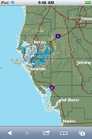
Weather Forecasts
Wind and weather forecast data would be nice to have in a my dream app.  Weather files could be downloaded over a cellular, Internet or satellite connection and overlayed on the charts.  Nexrad radar for weather could also be overlayed to show storms and fronts moving in.

Tides and Phases of the Moon, Sunrise and Sunsets
Tidal data is available in some navigation and charting apps already.  There are several apps that provide just tidal data. It would be nice to bring all this information including the phases of the moon and the sunrise and sunset into one app. 

Points of Interest
Chart data and connectivity are great but points of interest make the app truly powerful.  When your heading towards a port or harbour my dream app would be able to bring up the marinas, restaurants, bars and other points of interest in that area complete with phone numbers addresses and VHF channel for communication.  I could make a slip or dinner reservation on the way and be ready when I arrived.

Some of these features already exist but some do not.  I can only hope the developers are reading my blog and will take my suggestions when developing their apps. What features would you want in your dream app?

Saturday, January 15, 2011

FlytoMaps GPS All in One

Application: iPhone, iPad and iPod Touch
Function: Marine, Lakes, Parks
Cost: $9.99
Rating: **
I took a look at FlytoMaps because it had quite a few good reviews on iTunes. Remember one thing, don't always believe the iTune reviews.  The new version 2.5 will cost you $10 bucks but it allows you to download any of their charts for US and European national parks, NOAA nautical ENC charts, travel maps and some state lake maps.  These downloaded charts can be used for offline viewing. When connected to the Internet or through cell service you can access additonal Google maps, satellite maps and a hybrid overlays.

I was more interested in the nautical charting capabilities of the app so I downloaded the Florida charts.  I zoomed into an area that I was familiar with and noted more detail as I zoomed in.  The charts seem to be the NOAA ENCs that can be downloaded for free from the NOAA map site. So there is nothing special about the maps. There were no added feature or points of interest on these charts.  If you are familar with the NOAA ENCs they do provide accurate data for navigation buoys and depth soundings. Better navigation charts can be found on apps like  Navionics, iSailor or iNavX. Spend your money on these apps if you serious about marine navigation.

The app does allow the user to make waypoints by tapping the screen. The point can be added as a favorite or set as the destination.  It allows the user to name the waypoint and add a comments about the point.  A photo can also be geotagged and added to the point for reference. The app has a tracking feature which can be turned on and off.  Tracks can also be shown on the map or hidden with a setting. The tracks can also be named and saved for later use.

It does integrate GPS through the devices locational services and allows real time tracking. The main display also has a speedometer that enlarges when tapped.  The screen also displays the current destination and bearing to the current waypoint.  I found these two features very useable and functional.
The main display have four sofkeys on the bottom for GPS position, a search feature, waypoint function and tracking feature. There is also a banner for selecting map overlays and an Info button for downloading maps and Settings.

One strong feature of FlytoMaps is the Park Mapping. The do a great job in providing a wealth of information on the points of interests in national parts.  The topographical maps contain information on trails for hiking, biking, walking, stairways, horse trails. Points of interest include campgrounds, restaurants, ranger stations, picnic areas, boat ramps, parking areas. It would be handy to have this information when visiting your favorite park. There were no parks from my state listed, but it claims is has maps for 100 national parks.

FlytoMaps does some thing right but it leaves a lot to be desired when compared to the other marine charting apps.  It is a decent all around app for boating, hiking, and visiting parks but falls a little short on features for a major boating app.

Sunday, January 2, 2011

Transas iSailor Navigation and Charting App

Application: iPhone, iPad, and iPod Touch
Function:  Marine Navigation and Charting
Cost: App is free, charts are $4.99 per region
Rating:  ***

I am like a kid in a candy store when I am searching the iTunes App Store for new boating, sailing and navigation apps.  Today I found one that I had not run across or heard of before.  iSailor by Transas Ltd. has updated it's app to version 1.2 as of December 2010. The new version looks promising.
I had never heard of  the company Transas either but after a little research I found out that they are a world wide developer and supplier of navigation systems to the commercial shipping and aviation industry.  Their headquarters in in St Petersburg, Russia with international offices in Cork, Ireland.
The iSailor app is touted as an easy to use charting system for amateur boater. It has the basic features of a GPS navigation and charting program but comes up short of being a full featured program.  I guess I should not be so critical of a free app but I would rather see the company charge a little bit for it and add the features to make it a great app.


Features:
  • The iSailor app is free to download from iTunes
  • Chart sets are purchased for $4.99 to $24.99 each.
  • Chart positioning can use internal GPS or cellular location.
  • Charts are provided by Transas's own vector chart format TX-97
  • Charts are downloaded from within the app.
  • Chart orientation can be changed by twisting you fingers to orient the map anyway you want
  • Panning and multi touch capability are utilized to move around the chart
  • Soft keys on bottom of app include GPS, Info, Measuring, Record Track, Routes and settings
  • Monitors Lat, Long, Course and Speed on a overlay on top of the screen
  • Day and night chart coloring

Pros:
I liked the app but there are a few things that I found lacking when compared to some of the other apps in this class.  The bright spot with iSailor are the charts.  I am impressed with the look and feel of the charts themselves. Depths are shown in gradients with different colors.  There seems to be a lot of detail with lights, wreck and points of interest both on the water and shore.


One tap to the screen brings up the soft keys which allows GPS tracking, an information feature, a measuring feature, a track recorder, routing and settings. Tapping the GPS shows the users location on the chart.  The information features brings up a overlay on top of the screen that shows latitude, longitude, course and speed. Page to the right shows just course and speed. Page right again and it shows the active route.
The measuring feature worked by tapping and holding the pinpoint. The indication of distance and bearing is shown on the display. Track recording is turned off and on by tapping the track soft key a REC indication let you know when the tracking is in record mode. 

The routing function works by tapping and holding your finger to create a new point, continue tapping and holding to create additional points in the route. In the saved routes it also has a handy fuel consumption calculator. You can set your cruising speed and fuel consumption and it will calculate how much fuel will be consumed during that route.

Cons:
One thing that was missing was the ability to create and name a waypoints. This seems like a no brainer but maybe I am missing something here.  You can create points in a route and view those but there seems to be no way to rename them as a waypoint. It does have the ability to save and rename a route.  Within routes you can view the points but you cannot rename them.


I downloaded the app and bought a map region to give it a try. I like what I see so far but hope the authors will add additional features to build on an already slick looking app.