Saturday, December 20, 2014

Vexilar SonarPhone now on Navionics


Application: iPhone, iPad, iPod Touch, >iOS 4.3 and Android 2.0
Function: Marine Depth, Fishfinder, Sonar
Rating: *****
Cost: App is free, T-Box $149/$199

Along comes a company called Vexilar to shake up the sonar and fish finder world. They are a Midwestern company located in Minneapolis Minnesota. It is fitting they would be located in a state famous for great fishing and known as the Land of 10,000 Lakes.  They are probably more well known for their line of fish finders and underwater cameras for fishing and ice fishing applications.

They recently set the fishing world on fire with their SonarPhone application for smartphones and tablets along with the T-Pod and T-Box products.

Vexilar has their own free app called SonarPhone which comes in an iOS version or Android version found in iTunes and the Google Play store.

So, why am I so excited about this fish finder sonar?  Well, Navionics has recently released an update to their Boating and Charting apps that also incorporates the SonarPhone capabilities into their Marine apps.

If you purchase any of the T-Box product they can be easily connected to the Navionics app to provide sonar data and a depth display.  To get started, power the T-Box sonar unit up. On your mobile device enter Settings/WiFi and select the T-Box WiFi network.  Go back and open the Navionics app and the Sonar data should automatically be displayed on your chart display. See this YouTube video for easy setup instructions.

You can access the demo through the app in Menu/Charts and Upgrades. Select SonarPhone under Features.

Navionics app T-Box demo under Charts and Upgrades

Navionics App Note Sonar icon in bottom left on iPad

Navionics App Sonar chart split screen view on iPad


Vexilar App Features:
  • WiFi Connectivity to T-Pod, SP-200 and SP-300
  • Multiple user access via WiFi
  • Automatic Ranging
  • Transmit Range: 90 yards
  • Water Temperature, Depth Indicator
  • Audible Alarms for Fish/ Shallow/Low Battery
  • Gain settings
  • Depth Range
  • Depth alarm
  • Color Options
  • Fish Icon
  • Zoom Bottom Track
  • Noise Rejection
  • Chart speed
  • Keel Offset
  • Fish Alarm
  • Surface Clarity
  • Battery Indicator and alarm
  • Screen controls: Touch screen, split screen display with touch screen zoom control.
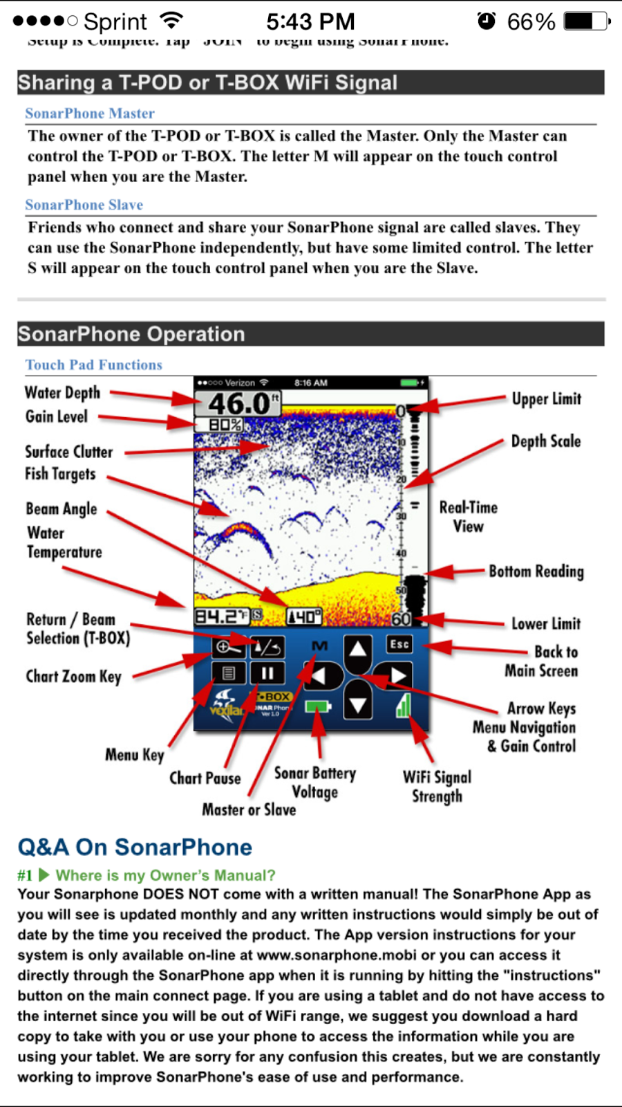
Vexilar SonarPhone App display features

Vexilar SonarPhone app iPhone
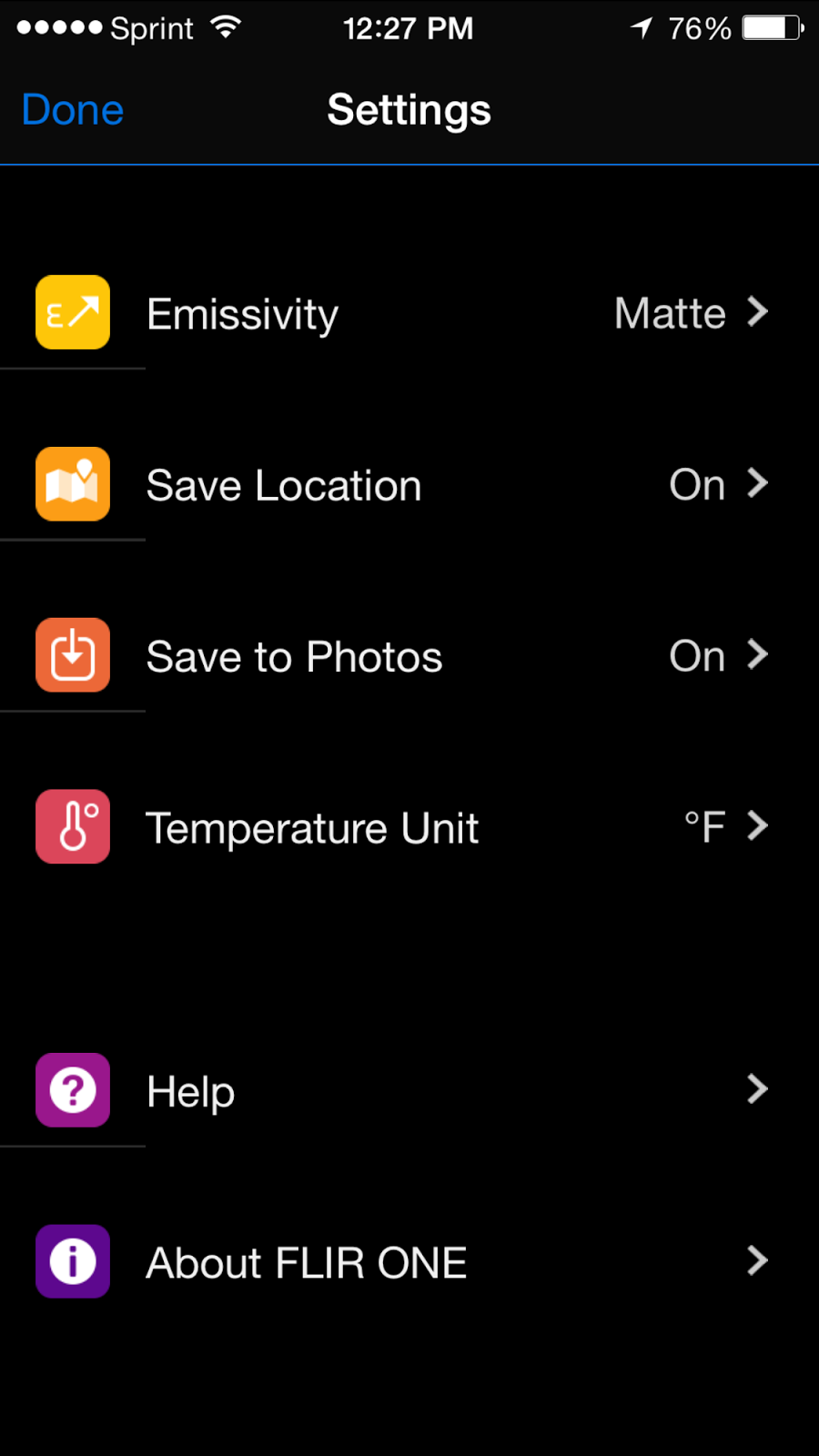
Vexilar SonarPhone app settings

Specifications - SP200 & SP300 Wi-Fi Boat Sonar
  • Permanent boat installation: (#SP200 only)
  • Portable boat installation w/suction cup transducer bracket: ( #SP300 only)
  • Transducer: High-speed skimmer-style transducer with keel offset and 6 meters of cable.
  • Max depth range: 240 Feet
  • Sonar frequency: 200/83 kHz
  • Dual Beam: 20º/40º
  • Power source: 12V DC power
  • Power output: 800 Watts Peak-to-Peak
  • Transmit speed: 100 Mbps
  • One year warranty
  • Included 12V, 4.5 amp-hour battery and charger. (#SP300 only)
  • Carry case with 12 volt battery and charger: (#SP300 only)

Vexilar offers several sonar units. The first is the T-Pod which is an rechargeable unit that can be towed or set in the water near your boat.  The onboard battery lasts about 4 hours. It has a water activated transmitter that will automatically start when it hits the water. It transmits through WiFi the same high quality sonar information to your smartphone or tablet.
If you fish from your boat or from shore this is a cost effective way to get sonar and fish finding information on your iOS or Android device. I found it for $115.00 on Amazon.com.


Vexilar also offers the T-BOX (SP200).  This is a unit that can be more permanently mounted on your boat.  This is the unit that I am most excited about. If you own a small boat or sailboat and don't want to invest is a chart plotter costing thousands you can have a fully functioning sonar system for only $149.00. Vexilar has made it that cost effective to add depth and sonar to your boat.


The T-BOX (SP300) is similar unit but is a mobile version that can be temporarily mounted on your boat or used for ice fishing. It has its own battery and retails for $199.00.
The SP-200 system can be easily wired into your boats 12 volt power supply. The sensor can be transom mounted and will provide depth, sonar data and water temperature in that configuration.
You can also mount the transducer inside your boat on solid fiberglass hulls. The transducer will work right through your hull if it is not a cored hull. You will lose water temperature in this configuration.  
The SonarPhone uses WiFi technology to create a WiFi hotspot.  It turns your smart phone or tablet into a fully functional sonar system. There is no limit on the number of users, so everyone on board can have access to the sonar data. You simply open Settings on your iPhones or Tablets and select the TBox WiFi network source, enter the network password and your connected. This system is not dependent on cell coverage so it will work anywhere.
The SonarPhone app offers their app in 17 languages for world wide use. 
There is no easier way to get high quality water depth, temperature and sonar onboard your boat at a great price. Vexilar and Navionics have made it seamless and super easy to put powerful sonar data in the palm of your hand.  
This would be a great stocking stuffer for Christmas. Hint, Hint!
*****Happy Holidays Everyone*****
~~~ Sail On ~~~ /)
Mark

Saturday, December 13, 2014

iPhone 6 Plus - Awesome Marine App Display

I have been racking my brain trying to come up with a worthy post this week.  I have been hunting high and low for a new app that would both amaze and impress you my loyal readers.  I have been somewhat distracted by getting ready for Christmas.  Christmas is just around the corner so I have been busy with preparations for that season.  The house is decorated, the tree is set up and all the lights are working.  I hope you are getting in the Christmas spirit too!

I recently upgraded my phone to the new Apple iPhone 6 Plus.  I used to have an iPhone 4s. It served me very well for the 3 years I had it. I skipped the iPhone 5 upgrade because I was not impressed with the added features and improvements made my Apple at that time.  I was getting a little big screen envy of the large phones Samsung was developing.  I had even toyed with the idea of buying an Android phone.

I ordered my phone directly from Apple and it took over 3 weeks to arrive.  I was able to back up my old phone to the iCloud so I was able to download all my apps, messages and contacts to my new phone. I sold my old phone back to Apple. They gave me $105 in Apple store credit for it which was about $30 more than some of the other third party sites.

I am totally blown away how great my marine apps are looking on the larger iPhone screen.  The 6 Plus has a 5.5 inch screen and the iPhone 6 has a 4.7 inch screen.

The shot below shows the size compared to a 7 inch Samsung Galaxy Tab 3 tablet.  Notice the narrower sides bars with allows the screen to fill up more of the display.


Here are a few of the stats compared to the iPhone 5.

iPhone 6 Plus Stats                                                    iPhone 5 Stats

5.5-inch (diagonal) LED-backlit widescreen Multi‑Touch display with IPS technology  4-inch (diagonal) LED-backlit widescreen Multi‑Touch display with IPS technology
1920-by-1080-pixel resolution at 401 ppi  1136-by-640-pixel resolution at 326 ppi
1300:1 contrast ratio (typical)  800:1 contrast ratio (typical)
500 cd/m2 max brightness (typical)  500 cd/m2 max brightness (typical)
Full sRGB standard  Full sRGB standard
Dual-domain pixels for wider viewing angles   
Fingerprint-resistant oleophobic coating on front  Fingerprint-resistant oleophobic coating on front
Display Zoom   
Reachability
 
The iPhone 6 has a new and improved 8 megapixel camera and a 1080P video camera. Video now includes slow motion and 120 or 240 frames per second. You can even take photos while recording video. The camera alone is reason enough to upgrade.

Here are a few of my favorite apps shown on the bigger iPhone 6 Plus screen. I am loving it! I am finding that I don't even use my iPad as much because the apps looks so great on the iPhone 6 Plus. They are easier to read even with my over 55 year old eyes.


Marine Information Display

NMEA Remote


iNavX


Navionics US

iSailor


SEAiq
 
Sea Nav

iRegatta Pro

I think the iPhone 6 Plus would be a great Christmas present for anyone, especially a sailor or boater. Be extra good this year so you end up on the "NICE List" and hopefully Santa will bring you one.  If you don't get one, there is no harm in buying one for yourself.  This could be considered required essential gear for any boating vessel. You can always argue that it is for safety reasons and you just had to have it to use all those great Marine Charting, Marine Data and Marine AIS apps.

*****Have a Super Holiday Season****

~~~ Sail On ~~~ /)
Mark

Sunday, November 30, 2014

Volvo Ocean Team Vestas Runs Aground

The Volvo Ocean Race management announced last night that the sailboat Team Vestas had run aground on a small reef north of Mauritius in the Indian Ocean. The vessel grounded on the Saint Brandon(Cargados Carajos) archipelago which is comprised of a number sand banks, reefs and shoals.  The reef measures more than 50 km from north to south and is 5 km wide. Saint Brandon is located in the India Ocean about 430 km northeast of Mauritius.


Image from the Volvo Life at the Extreme App
The yacht was racing along with the other six Volvo Ocean 65 foot sailboats in the second leg of the round the world race. The second leg started in Cape Town South Africa and will end in Abu Dhabi.

Race officials were notified on Saturday evening that Team Vestas had run aground.  Several other yachts ahead of Vestas had passed the reef on the west side just a few hours ahead of them. Team SCA passed to the east of the reef later that night without incident. Vestas is the blue boat shown in the image above.  This is an image from the tracker section of the  Volvo Ocean Race app available for iPhone and iPad.

Later reports from the Volvo Ocean command center reported the yacht was aground and both rudders were broken off.  A leak in the stern of the yacht was allowing water to enter the aft watertight bulkhead area. .

Team Alvimedica was placed in standby and was asked to provide assistance to the Vestas team during the night if needed.  All nine crew members were accounted for and no injuries were reported aboard Vestas. Alvimedica motored within a few miles of Vestas just behind the reef to the west of the grounded vessel.  They remained on the scene until Coast Guard and rescue personnel arrived just before dawn on Sunday morning.  All Vestas crew members were transferred to rescue vessels shortly there after.

Race officials reported that the Vestas crew will stay in a facility on Ile du Sud until arrangement can be made to extract the crew.  Plans then can be made on how to salvage the multi million dollar yacht.
   
Team Alvimedica was released after the rescue personnel arrived and have rejoined the race to Abu Dhabi.  They will be compensated for the time they lost while they remained in standby aiding Vestas.
Image from Google Earth

Wow! the first thing that came to my mind was, how could this happen?  These yachts have the best state of the art equipment and the most highly trained crews in the world.  I cannot conceive how a yacht of this caliber could ever run aground in the middle of the ocean.  I guess we should not be so quick to judge until we have all the facts.

This is the first time the Volvo Ocean race has sailed to Abu Dahbi. Concerns of pirates on the east coast of Africa forced the race officials to ship the yachts to Abu Dhabi the last time the race was held three years ago.  So sailing in these unfamiliar waters may have been a contributing factor.

I am sure there will be a million articles attempting to figure out how this happened. Was it human error, was it bad electronic charts, who is to blame?  It is no doubt a huge oversight by someone.  My heart goes out to the sailors onboard.

The Google Earth screen shot above clearly shows the sliver of an island and the reef north of Mauritius. This appears to be the area where Vestas ran aground when you compare it to the Volvo Ocean Race Tracking position.

The image on the left is a close up Google Earth image of the Saint Brandon reef.  This low laying reef is a sunken atoll which is at times partly under water during high tide.

I do not own any charts for this area and I do not know what type of charting systems these boats had on board.  Apparently they were not adequate enough to keep the boat out of trouble. Perhaps an app like the Active Captain Companion would have alerted the navigator to the approaching hazard and shoals and prevented this tragedy. Would the Navionics Boating App Auto Routing feature factored in the shallow area and guided the boat safely around the shoals.  Having an app with view of satellite imagery would in this case made it obvious shoals were ahead. If the navigator was using a crowd sourcing app that had this spot listed as a hazard they might have been alerted to the problem.  I am impressed with the way mobile apps have continued to add features that address safety and security in real time navigation.  Maybe it is time for the Big Chart Plotter companies to rethink their approach.

This incident should be a lesson to us all.  Make sure you know the waters that you are boating in.  Check all sources of information including paper charts, electronic charts, satellite images and local knowledge. Don't rely on one set of information.

If I was racing in a multi million dollar yacht at 20 knots I would want to use all the tool available to me. There was apparently a serious lapse in judgement by someone.  The other 6 yachts were either aware of the shoal or just lucky to avoid it.  The crew of Vestas is fortunate in that no one was hurt and the boat can possibly be towed off the reef. There are probably a few bruised egos on Vestas following this incident. I am sure they will all be back racing again after learning this important lesson. 

What do you think happened?

~~~ Sail On ~~~ /)

Mark


Saturday, November 22, 2014

FLIR ONE for iPhone 5/5s

Application: iPhone 5/5S
Function: Thermal Imaging camera
Rating: *****
Cost: App is free, FLIR One camera $349


The FLIR company provides state of the art night vision and thermal imaging cameras for law enforcement, maritime first responders,  commercial and personal use. Their marine thermal imaging cameras have been featured in all the boating magazines. 

Many of the megayachts now come with night vision and thermal imaging cameras as standard equipment. Some of these marine commercial cameras can run as high as $20,000.

If your not a mega yacht owner you can still have access to this technology. FLIR also produces hand held night vision units from or $2000 to $8000.

The company's latest development, the FLIR ONE, now makes this technology available to an average boater. The FLIR ONE is a thermal imaging camera attachment for the iPhone 5 or 5s. At $349 it is a low cost alternative to the other more expensive cameras in the FLIR product line.  The infra red camera is housed in a sleek sleeve that the iPhone slides into. It looks much like an external battery charging case. The sleeve houses the thermal imaging camera and a normal camera for enhancing the image.

Features:
  • Live thermal imaging/night vision display
  • iPhone 5/5s compatible
  • Camera sleeve with battery
  • Load images and videos to camera roll
  • Upload images and video to Facebook, Twitter, Instagram
  • Separate battery for with 2 hours of continuous use
  • Mini USB charging
  • See what the naked eye cannot
  • Detects temperature differences of about one-tenth of a Fahrenheit degree, and the temperature readout is accurate to within 2 degrees.
  • Observe heat sources, heat differences, fire, overheating equipment or components
  • See through smoke and haze
  • Detect insulation leaks and energy efficiency problems.
The FLIR ONE app is the interface to managing the camera settings and images taken by the device. Start by attaching your iPhone 5 or 5s to the FLIR ONE sleeve.  Move the switch to the middle position to turn on the device.

You can now see live thermal images on your phone's screen. The FLIR ONE uses MSX technology which utilizes two cameras. One camera picks up the thermal imaging and the other picks up a visual image. The two images are combined to create a unique viewable image.

The FLIR ONE thermal imaging can be used for a variety of applications around your home or on your boat. The thermal imaging also provides night vision and could help you to locate objects in the water or other vessels ahead during the night.  If you have a man overboard situation on a pitch black night you may never find that person.  Thermal imaging could help to locate that person by viewing their heat signature on the device.

Use it in the engine room to take a quick scan of your batteries and wiring connections to locate hot spots before they cause a failure or fire on your yacht.


The Settings page allows adjustments for Emissivity, location, photos and temperature units.

Images and video can be taken using the on screen buttons similar to taking photos and video with the iPhone camera app.

The app makes it easy to collect and share your interesting and useful thermal images. Images and video are easily captured and can be saved directly to the Camera Roll on your device. Images can also be share on Facebook, Twitter and other social media channels.

The images and video show temperature differences by the variations in color. The darker parts of the image a cooler and the brighter parts of the image are hotter in temperature.


I could see occasionally using it around the home or boat. I am not so sure I would fork out $349 for the device. Although Christmas is coming, so if you have that hard to buy for Gadget Geek this might be just what he would love!

Having the device on the phone would make it very handy to use. I might be surprised how much I would use it if I carried it around everyday.

Is anyone using this device? I would be interested in any feedback from actual users.

~~~ Sail On ~~~ /)
Mark

Saturday, November 8, 2014

Microsoft Office - Free Apps for iOS Devices

Application: iPhone, iPad, iPod Touch
Function: Word Processing, Spread sheet and Presentations
Rating: *****
Cost: Free, in app purchases for additional features

I know, these are not exactly marine apps, but they are very useful for anyone who needs to keep a ships log or keep track of finances or a parts inventory on a yacht. It is now possible to create and edit Office documents from all your mobile devices anytime anywhere. How cool it that?

On November 6th, new versions of Word, Excel and Power Point were released for use on the iPhone, iPad and iPod Touch.  These new updated versions are optimized to work on all of your iOS devices.

To get started download the apps from the Apple App Store. You will need to sign up for a free Microsoft Live account  to initialize the apps. Your live account provides access to your Skype, your Office 365 subscription, games, music and movies from Microsoft's participating stores. It also allows you access to all of your photos, videos, and documents on OneDrive. Your account consists of an email and password, plus your profile info, billing and payment details.

The prior version of the Office for iPhone was just a single app that let you connect with your Microsoft OneDrive. It lacked many of the document creation features of the new suite of apps.  The old version also required a subscription to Office 365 to do anything more than read. The new versions allows many of the basic viewing and editing features such as making edits to words, fonts, font sizes and font color. Making more complex formatting changes to documents and spreadsheets will require purchase of an Office 365 subscription.  The basic features will probably be good enough for most people for light everyday use.

The Office 365 subscriptions will run you $6.99 a month for a single desktop and mobile version. For $9.99 a month you get Office 365 for 5 computers and 5 mobile devices.  These in app purchases will be charged to your Apple account.  The subscriptions will automatically be renewed unless you turn off auto renew in your iTunes account.

With your free Microsoft Live account you automatically get 15GB of free space on OneDrive which is Microsoft's cloud storage service. This account allows you to save and open documents across all your devices.

These new apps have been designed specifically for use on the for iPad, iPhone and iPod touch. They work seamlessly by adjusting to the screen size of your iPhone or iPad.

Word

Word documents now display nicely on your iOS iPad and iPhone. When you edit or create documents, you can be sure they will look exactly the same across all platforms including PC, Mac, tablet and phone. Word, Excel and Power Point all have the familiar Office look and feel.  The interface is very intuitive to use with all the common touch gestures. 

Features:

• Images, tables, charts, SmartArt, footnotes, equations 
• On your phone, choose between the real document layout or an easy-to-read layout.
• View email attachments and access Word documents from OneDrive, Dropbox, OneDrive for Business, or SharePoint.
• Pick up from where you left off because Word knows what you were working on last, no matter what device you were using.
• Print Word documents to an AirPrint printer, with or without markup.
• Content and formatting are maintained across all your devices - PC, Mac, tablet and phone.
• Rich formatting including fonts, pictures, tables, charts, textboxes, shapes, footnotes and page layout.
• Track changes, add comments and work simultaneously with others on the same document.
• Word automatically saves your document, so you can rest assured that you don't lose all your work while you're on the go.
• Simply share your work with others by emailing a hyperlink, the file or a PDF.

Microsoft Excel

Excel is the most popular spreadsheet application and can be use to keep track of your spare parts inventory, finances and expenses while afloat.  I have built several spreadsheets for use on board to keep an inventory of all my storage lockers.  I never have to guess which locker or bin something is stored.

All of the new Microsoft apps allow the files to be save, emailed or exported to your Microsoft Drive or Dropbox accounts. Dropbox and Drive will automatically update the saved files on all your devices so you can work seamlessly from home or on the water.

Features:

•Formulas, tables, charts, comments, PivotTables, sparklines, conditional formatting .
•Excel spreadsheets look just as they do on your PC or Mac.
•View email attachments and access all your Excel spreadsheets from OneDrive, Dropbox, OneDrive for Business, or SharePoint.
•Pick up from where you left off because Excel for iPad knows what spreadsheet you were working on last, no matter what device you were using.
•Print an entire Excel workbook, a worksheet or a selected range to an AirPrint printer.
•When you edit a spreadsheet, your content and formatting are maintained across all your devices – PC, Mac, tablet and phone.
•Use formulas, charts, tables, sorting, filtering, and more.
•A special formula keyboard lets you add numbers and formulas rapidly – much easier than with the standard touch keyboard.
•Excel automatically saves your spreadsheet.
•Share your work by emailing the spreadsheet, a hyperlink or a PDF.


Power Point

Power Point is great for making and editing presentations on your iPad or iPhone. It may not be very useful to most boaters but you may someday need to create a presentation of your recent travels to share with your yacht club or friends. Power Point allows you to make engaging and dynamic presentations for your audience. Power Point allows you to easily insert text, pictures, video or links to the Internet in your presentations.


Features:

•Themes, images, tables, charts, SmartArt, transitions, animations are all there, nicely formatted.
•PowerPoint presentations look just as they do on your Mac or PC.
•When presenting, see your speaker notes and use the built-in laser pointer, pens or highlighters to get your point across.
•View email attachments and access all your PowerPoint presentations from OneDrive, Dropbox, OneDrive for Business, or SharePoint.
•Pick up from where you left off  no matter what device you were using.
•Print to an AirPrint device.
The apps are free so go ahead and add them to your devices.  If you find you need more features and options you can always sign up for the paid premium versions.  Who knows, if you work while you travel you may have a need to edit documents on the fly. These apps give you the freedom to do that from any of your mobile devices.


~~~~ Sail On ~~~~ /)

Mark


.

Saturday, November 1, 2014

SeaPilot 3.7 Marine Charting App (US Version)


Application: iPhone, iPad, iPod Touch, Android versions also
Function: Chart Plotter, Routes, Marks, GPS, AIS, Instrument data
Rating: *****
Cost: App is free, in app purchases

SeaPilot has been around for a while but it was previously only available in Sweden in the Android version of the app.  The recent release of SeaPilot, the US iOS version caught the attention of i-Marine Apps.

There has been quite a dry spell recently with the absence of any new charting apps to write about. Most of the news has just been about updates and the addition of some new features to the existing apps. So I am pumped to see that SeaPilot finally came around and "drank the coolaid" to produce an iOS app for the iPad and iPhone.

SeaPilot was developed by Anders Bergstrom and his company True Heading from Sweden. This spring they rolled out a new division of their company to offer their products to the US and North America. Swedens's waterways are very well known for being covered by an extensive network of AIS markers and buoys. The Swedish government also has their own Internet based AIS system which can be licensed to commercial users.

The app has some nice features including GPS tracking which provide bearing, distance and cross track error to your destination. AIS and instrument data can be acquired from your on board WIFI and AIS network. Routes and Marks allow navigating a pre-defined route or to a waypoint.

The Swedish version of the app is available with charts for Norway, Sweden, Finland, Estonia, Latvia, Poland, Germany, Denmark, Netherlands, Belgium, Great Britain, Ireland, Iceland and France.

Features:
  • Positioning via GPS
  • Visualization of S-57 chart data from National Maritime Administrations
  • AIS data from National Maritime Administrations via Internet (3G or WLAN)
  • Course and speed vector for AIS targets
  • AIS weather data in real time from national weather stations - SWE
  • Autonomous navigation - charts (In-App-purchase) downloaded to the iPad
  • Free chart udates
  • MOB return to a marked position
  • Option to track your own boat on the chart
  • Displays position, course and speed
  • Adjustable speed and course vector
  • Display settings for day, dawn/dusk and night
  • Routes/waypoints (Export/Import functions in GPX-format, save to list)
  • Past track (Export/Import in GPX-format, save to list)
  • Plotting/marking objects (Export/Import in GPX-format, save to list)
  • Electronic bearing and range marker from own vessel
  • True Motion and adjustable North Up / Head Up chart orientation
  • Chart object search
  • AIS target search
  • Setting of safety contour (2, 3, 6, 10 and 15 meters)
  • Hide/show status, tool bar and own AIS target
  • NMEA-0183 interface for connecting external GPS/AIS via WIFI
  • High definition (HD)
  • World chart for rough overview/orientation
  • Facebook integration allows sharing position with friends and family 
The app is very intuitive and easy to use with common touch screen gestures. The main screen displays the charts and instrument data is across the top of the screen. Seven soft keys at the bottom are used to access the other app features and settings.

Charts

To be able to download charts you will have to set up an account with SeaPilot.  You can then download charts after performing an in app purchase. The purchase will be charged to your iTunes account.

Charts can be purchased and downloaded from the Settings Menu using the far right gear looking icon.  For the United States they offer the US-East for $13.99, Great Lakes for $38.99 and US West for $13.99. The app does allow you a few days for a free trial of the charts and features. After that you have to purchase a set.  The prices seem a little on the high side. I am not sure why the Great Lakes Charts are $38.99. They may to be targeting the commercial shipping market at this price.

I trial downloaded the US-East charts for this review. Make sure to use a WiFi connection for a faster download of the charts. The charts are provided in the S57 format so they adhere to the International Maritime Organization (IMO) standards.  This format allows information to be place in layers so the basic chart data is not so cluttered. 

Instruments

The instrument bar at the top displays latitude, longitude, wind speed and direction.  Additional display of wind angle, route to destination, bearing and cross track error readings will appear when you select and activate a route or select GoTo a mark.

If  you want to activate access to the WiFi NMEA data on board your yacht you will have to pay an annual $13.99 fee to license this feature. The app does not accept any NMEA 2000 data at this time.

AIS Data can be downloaded and displayed also over the NMEA connection. The target name, vector and station name can be displayed. The app can use your AIS transponder data on board or it can us an Internet based AIS system. This requires another annual subscription of $19.99.

 GPS Tracking

The SeaPilot app will use the GPS signal from your device if it has one. If your device does not have GPS such as a WiFi only iPad you can use a variety of Bluetooth GPS devices. To select the internal devices GPS go to Settings/Use GPS to turn this feature on. Once the GPS is enabled you should see the latitude and longitude position in the upper left corner of the display. If the data connection is lost it will turn red indicating bad position data.

Routes/Marks

Routes are easily created and modified right on the screen. Tap and hold your finger any where on the chart.  A pop-up box will come up displaying Position, Mark, Route and Weather selections.

Route selection options are Create Route and GoTo.  Tap Create Route and start adding points by tapping on the position you want the route to follow. Route markers can be adjusted by tapping and holding on the mark and moving it to the new location. 

Marks are basically waypoints. These can be created at any location with a tap of your finger.

To select, display, delete and edit your created routes tap the Route icon at the bottom of the page. This is the icon fourth from the left at the bottom of the screen.

Marks can also be selected to display and delete the marks that you have created. Other options can be accessed by selecting the Flag icon at the bottom of the screen.

AIS

SeaPilot has two ways to access AIS data. It can provide AIS targets on your device from an Internet based AIS system such as Marine Traffic or other land based networks. The update speed for these AIS targets is a maximum 10-20 seconds.  AIS targets for the closest 100 vessels to your position are provided for display in the app.  This feature must be purchased annually and will cost $19.99 a year. This feature has to be turned on in Settings/Internet AIS for it to work.

The second way AIS data can be used by the app is with an AIS transponder on board your ship. The AIS transponder is not dependent on an Internet connection to send or receive AIS data for ships near your position.

Weather

The Weather information is provided by the MeteoGroup.  Data includes coastal weather forecasts in one-hour intervals for any position on the chart.  The weather feature requires an Internet connection by WLAN or Mobile coverage. The weather feature must be purchased within the app under Settings/Subscriptions. The Weather data will cost $9.99 for the annual subscription.  This seems kind of steep for basic weather data.

Tap and hold your finger anywhere on the screen to view the weather data at that location.  Note the crosshairs are offset from your finger for accurate placement. As shown in the image, temperature and wind speed and direction are displayed. Hourly data can be viewed by selecting a specific day.

SeaPilot has all the basic features you might want in an introductory app. I like the app and the wide variety of features but find it frustrating that I have to subscribe to each feature separately. The subscriptions are only good for a years so I have to pay for the features all over again year after year. I personally find this pricing a little aggressive when compared to other apps with more features.

Some features that the app is lacking are NMEA 2000 compatibility, GRIB file download, points of interest, tides, anchor alarm, compass display, trip data and expanded instruments data. I hope they will work on adding this functionality.

Charts $13.99-$38.99 per year
AIS $19.99 per year
NMEA Data $13.99 per year
Import/Export $13.99 per year
Mark and Routes $13.99 per year
Weather $9.99 per year

I welcome the SeaPilot app to the US market and hope they can compete with the popular apps like iNavx, SEAiq, Garmin BCM, Navionics and SeaNav.   The more competition the better! That the American way!

Has anyone used the SeaPilot app? I would like to hear what your experience has been.

~~~ Sail On ~~~ /)
Mark


Sunday, October 12, 2014

Iridium Go, Mail and Web Apps

Application: iPad, iPhone and iPod Touch iOS 6.0 or later, Android
Function: Satellite voice, text, data, SOS and Internet
Rating: *****
Cost: Iridium Go $799, apps are free

I don't usually write about many hardware devices but when a piece of electronics becomes a game changer for the industry, I have to give it some press. The Iridium Go is just that. It is the latest satellite communicator to find its way into the cockpits of pilots, sailors and world travelers of all types who want world wide communications at any time. The cool thing about this device is that it is affordable and the flexible monthly plans won't break the bank. A compatible Iridium Go IOS and Android apps are used to connect you mobile devices and make phone calls, text, track, Tweet and SOS.  The Iridium Mail and Web app allows access to email, weather, Facebook, Twitter and the Internet. I am not sure why they need two apps, it would have been nice to have all features in one app. 

This awesome new portable satellite device eliminates the no cellular service problem. The Iridium GO offers 100% global coverage for smart phones to make and receive calls, send and receive instant messages, send & receive email, browse the Internet, send files and track your GPS location.

The Internet connection is quite slow at 2.5 Kilobits per second. It is enough to do the basics such as sending small files or checking the weather from a online weather sites. The GO is a Wi-Fi hotspot for up to 5 Apple  or Android devices. Connections can be made up to 100 feet (30 meters).

Features:
  • Dimensions: 4.5″ x 3.25″ x 1.25″ (114mm x 83mm x 32mm)
  • Weight: 305g
  • Antenna: Internal Iridium
  • Concurrent GNSS: US NAVSTAR GPS, GLONASS, Galileo
  • Durability: MIL-STD 810F
  • Ingress Protection: IP65
  • Operating Temperature Range: -10°C to +50°C
  • Storage Temperature Range: -20° to 60°C
  • WiFi Frequency and Range: 2.4 Ghz b, g, n (up to 30 meters)
  • WiFi Interface: Iridium GO! API
  • Included Applications: Iridium GO! (Phone, SMS, SQS) and Iridium Mail (Mail, Photo, Weather)
  • Number of Users: Up to 5 with Iridium GO! App
  • Battery Specs: 3600 mAh providing up to 5.5 hours talk time/ Up to 15.5 hours standby
  • Battery Charge Time: 4 hours
  • Interface Connectors: SIM, Micro USB, External Antenna
  • External Antenna: TS-9 (TS-9 to TNC adapter available)
  • Regulatory Certifications: FCC, Industry Canada, CE, ITU, RoHS
  • Phone - Make or receive phone calls on your smartphone with a new satellite phone number.
  • Email - Send and receive email and email attachments via the Mail and Web App.
  • Instant Messaging - Sent a text to any phone number or email address. 
  • Web Browsing - via the Opera Mini (iOS) or XWeb for Android devices. 
  • Files - Send files or photos from the Mail & Web app.
  • GPS & Tracking - Show current position - GPS button instant texts/email once or at selected intervals.
  • Twitter - Send a tweet directly from the Iridium Go app.
  • Facebook - Connect to your Facebook account through the Mail and Web app.
  • SOS Button - Send an emergency message, or set up to send an SOS to a defined text address/email.                        
  • Weather App - Press the weather button inside the mail and web app for local conditions.
  • Wi-Fi Hotspot up to 100' (30 meters) from the device. May connect up to 5 devices (Smartphones and Tablets only).
  • 100% Global Availability, Pole-to-Pole, land, sea, air
  • No roaming charges.
  • Voicemail, Contact Lists.
  • Offline email composition. Write emails anytime and send only when you connect.
  • Advanced Screens - Firewall controls, Wi-Fi security, device passwords, Tracking configuration
  • Compatible with Iridium external antenna
  • Display shows signal strength, data Internet access, number of connected users.

Satellite Network

The Iridium satellite network is the most complete and offers world wide coverage. The 66 LEO, low Earth orbiting satellites provide coverage to every corner of the earth. This is great for world cruisers who are often crossing remote oceans and are out of touch with land based communications. The network was originally designed for voice communications so it is not a high speed datalink. 

Iridium Go Hardware

The Iridium Go is a ruggedly constructed device which is designed to be waterproof and shockproof.  It has a compact form factor of only 4"x 3".  It can be mounted in a variety of ways but must have clear view of the sky to pick up the satellites. Simply flip up small antenna and the unit turns on automatically.  An optional external antenna can be used to provide more mounting options.

While turned on the unit provides a WiFI hotspot for up to 5 mobile devices connected simultaneously.  The unit connects with either an iOS or Android version of the app which are used to make voice calls, text, download files, send SOS and browse the internet.  The unit has a rechargeable battery and will last about 8 hours of active use or about 15 hours in standby.

Iridium GO App

The Iridium go app is your user interface to the hardware unit.  It was designed for a variety of tasks. Your phone is connected to the Iridium GO unit with a WiFi connection. You can then make voice calls, sent text messages, Tweet, track your GPS position and send an SOS if case of an emergency.

The main screen of the app has icons for the various functions. At the top of the display it shows connectivity and battery strength.

You will need an Iridium service plan and a login to access the network.  Iridium Go has 4 Monthly Rate Plans ranging from a minimum of $49 to the unlimited plan for $125. Two Pre-paid Data Plans are also available. The monthly rate plans provide an increasing number of GO Data minutes per month. There are no roaming charges when you use Iridium GO. There is a one-time activation fee of just $50 with any of the Monthly Rate Plans.

Pre-paid plans offer you a pre-set number of GO Data Minutes that you can apply to all your data, voice and messaging needs. So, if you want to make a voice call to any landline or mobile device you will use have a set number of minutes of voice calling.  There is no activation-fee with the prepaid plans. Prepaid plans can be re-new at any time, and un-used minutes roll over when you renew your plan before the expiration date. 

Voice Calls:

Satellite communications systems were developed by a couple of Motorola engineers back in the 1980s.  Iridium had the first operating satellite network system which started offering service in November 1998. 

Voice calls are made using the Iridium GO app. Simply connect to the Go WiFi network and access the keypad for dialing.  The app can access all your contacts so it make it easy to make calls.

You can make and receive calls from your smart phone over the Iridium network.  All incoming calls are free. However if someone calls your Iridium number they will rack up a pretty large phone bill. This is because they will be charged international rates.

Iridium does offer a cheaper way to do this. The user must set up a +1 number to allow the caller to first call an access number and then dial the Iridium users phone number.  The caller will then pay standard long distance rates.
 
 Text Messages
 
Texting is almost more popular than talking these days.  I know I do more texting with my kids than talking.  The ability to send and receive satellite text messages is probably the best feature of the app.
 
While your in remote places exploring the world it is a nice feature to be able to send you spouse or loved ones a quick text letting them know you are ok and still alive.  You can update them on your travels and any change in your arrival times to put their mind at ease.
 
Tap the Message icon on the main screen to access the text feature.  A familiar looking screen show your conversations.  Messages can be up to 1000 characters.  Two of the Iridium Go service plans allow unlimited texting. 
  
SOS, GPS Position and Tracking
 
The Iridium Go has an an board GPS receiver that can be used to provide your location.  This location information is useful and can be sent in a Text or Email.  These position updates can be sent out manually at anytime or they can be set up to be sent out at regular intervals.  The recipient of the message can then view the position data on a map.  This is a position only and not a tracking feature.
 
The SOS feature is a free service and can be used in an emergency situation to summon help from anywhere in the world.  The feature is set up ahead of time by providing emergency contact information so authorities know who to get ahold of.   The SOS messages are monitored by the GEOS Alliance. If they receive an SOS from you they will initiate contacts with local law enforcement and rescue personnel. The SOS can be started with the dedicated button the Iridium Go unit or on your phone under the SOS Icon
 
The Tracking feature is accessed with the Tracking Icon. It uses the GPS data of the Iridium GO module to provide a track of your travels. This is a bread crumb like trail of where you have traveled.  This can be used for tracking mobile trucking assets, planes, ships and hikers if needed. 
 
Social Media
 
Social Media can be accessed also.  If you want to Tweet or post an update you can do that also through Iridium GO.  The Twitter Icon lets the user access a Twitter like feed. This is an Iridium app so the functionality will not be the same as the regular Twitter app.
 
Iridium Web and Mail App
 
I am not sure why Iridium has two different apps. The main screen of the Web and Email app is shown on the left.  It also has a Twitter icon, Facebook, Weather, Web, Photos and Mail.
 
The Mail, Facebook and Twitter icons are self explanatory just select these to email, post your status or Tweet.
 
One of the coolest features is access to the Internet.  This not going to be a high speed connection. It is more like the old dial up modem speeds if you are old enough to remember those.
 
To access the Internet you will have to use the Opera Mini app.  Make sure to set the Image Quality settings to low to maximize compression of images. You will not be able to stream videos or visit other broadband intensive sites.  It can only be used for basic web browsing and file downloading.
  
Iridium has made an awesome device that can be interfaced with about any mobile device.  The price of the device is kind of steep at $800 buck but the monthly service plans for unlimited service is only $125 per month.  I pay almost that much for my family plan for a few cell phones.  If you travel to remote locations it might make sense to pick one up. If your a world cruiser it will give you worldwide communications and the ability to download GRIB weather data files for programs like Predict Wind or Weather 4D.  Is anyone using the Iridium Go while cruising?  I would love to know what your experience has been.
 
~~~ Sail On ~~~ /)
Mark