Thursday, November 29, 2012

Garmin BlueChart Mobile Trip Planning App

Application: iPad, iPhone, iPod Touch
Function: Marine charting, planning and reference
Cost: Free
Rating: ****

The long awaited Garmin BlueChart app has finally hit the streets.  We were teased with a few screen shots back in February and promised the app this past summer. Well it was worth the wait. Garmin took their own sweet time and did it right.  I have owned numerous Garmin products over the years and have never been disappointed. This app also delivers with a ton of awesome features.

If you have not downloaded it yet here is the link to the app in the iTunes Store.
https://itunes.apple.com/us/app/garmin-bluechart-mobile/id523635526#

Garmin has been advertising this app as a trip and planning tool and that is what they delivered.  The list of features is extensive but there are some additional features that I wish it had. More on that later.

Features:

  • Create, edit Waypoint name and symbol as water, land, hazard with custom colors
  • Create and edit Routes
  • Picture of saved Routes
  • g2 marine Cartography
  • In app purchases for charts and advanced weather
  • Transfer routes and waypoints wirelessly to networked Garmin chartplotters
  • Fuel usage calculations in routes
  • Record Tracks
  • Chart notes
  • Celestial data, sunrise sunset, moonrise, moonset and phase
  • Tide stations
  • Currents
  • Active Captain user generated content points of interest
  • Garmin points of interest
  • Weather conditions, dew point, temperatures, wind speed and direction, water temp, visibility, wave height and period
  • Grib files
  • Premium weather in app purchase for radar and clouds $3.99
  • Graphical measuring tool
  • Shaded depth contours and inter-tidal zones
  • Spot soundings
  • Plan trips 
  • Radial menu dial
  • Powerful search feature for BlueChart services and ActiveCaptain content 
  • Realtime GPS tracking
  • External GPS capable 

Chart Menu: 


The apps main screen has a basic world map with banners at the top and bottom. The top banner has a gear icon on the left to select the Settings menu, a Heads Up button toggles between Track Up and North Up settings.  The center panel will give the status of your GPS connection if your connected via WiFi to your Garmin MFD.

The Record Track button starts and stops track recordings.  The Magnifying Glass icon lets you search the vast points of interest database.

Additional menu selections at the bottom center of the screen allow control of the Measuring Tool, My Content wheel icon and the Tides and Currents icon.  The Speed and Heading readings straddle these main icons left and right.

The last icon on the bottom far right is for selection of Chart Content. Chart content allows you to select various items to view on the display. These include Routes, Tracks, Waypoints, Tracks, ActiveCaptain POI, Weather, Grib weather files, and premium weather.

Charts:


Charts are easily selected and downloaded from with the app. Select the Gear Icon settings menu and select the BlueChart Maps option. 

There are 9 different chart sets available for purchase. US Coastal, $29.99, North America, $44.99, Australasia & Africa, $69.99, South America, $59.99, Mediterranean, $59.99, Nordics, $49.99, and Australia & New Zealand, $43.99.

Garmin charts are some of the best in the industry. The markers, depth gradients, colors and annotations are clear and concise.

Once you have purchased the chart set you can start to download the portions of the chart that you want to display.  Simply tap a tile to download it or tap a downloaded tile twice to remove it.

Charts will also be automatically downloaded when you zoom in to an area on the main chart display.

Routes and Waypoints:


Garmin has created a new Radial Menu to create, edit and inform the user of items on the charts. Simply tap once on any chart item or location on the chart and the Radial menu will pop up.

Tap on a chart item to have it pop up in the Radial menu where you can select them for more information.

Position coordinates are displayed for the center of the Radial Menu. Options for creating a Route or Waypoint are on either side of the three dots. Tap the dots for additional menu selections of Chart Notes and Celestial information.

Routes can easily be created by selecting the Add Route button on the Radial Menu.  Route points can be added with a tap of the finger or moved to a new location by dragging the route point to the desired location.

As you add legs to your route the leg distance, fuel requirements, time and bearing are listed.  This a great tool for planning your routes and estimating fuel and time for your passage.

Routes can then be edited by going to the Wheel icon on the bottom of the screen and selecting Routes in My Content. You can then select the options of Edit on Chart, Delete or View on Chart.

Routes and Waypoints can also be uploaded to your WiFi connected Garmin Chartplotter with the optional WiFi Adapter

Waypoints can be added by tapping on the display where you want to add a Waypoint.  Select the Add Waypoint button on the Radial Menu.

A popup box with display the name, symbol, coordinates, depth and a notes section.  You can rename the waypoint by selecting the Name field.

The Symbol can be changed to a variety of different icons. Tap on the Symbol box and select from General, Water, Land, Hazard and Shape menus.

There is a ton of different icons and colored markers to place as symbols.  Garmin did a great job in providing about any symbol you might need

Measuring Tool:


Garmin has provided their version of  a nice distance and bearing tool.  It allows you to quickly determine the distance between any two points on the chart.

Select the Protractor Icon on the bottom of the screen. Two marker circles will come up. These markers can be moved by dragging them around with your finger.

The blue marker is the start and the pink maker is the destination.

On the top of the screen a banner conveniently shows the Bearing, Distance and Return Bearing.

Weather:


One of the best features of this app is the amount of weather data that Garmin has provided.  The app requires that you purchase charts before weather data is available.  Basic weather is accessed with the Chart Content icon in the bottom right side of the display. Weather station data including buoy and land based NOAA weather is available for viewing.  

The only drawback is that it is limited to displaying one weather data type at a time.  Here I have selected Weather station temperatures.

Weather selections include conditions, dew point, temperatures, wind direction and speed, water temperature, visibility, wave height and period.  Grib forecast wind data can also be selected.

Premium weather includes Nexrad radar and cloud cover.  This can be purchased for $3.99 under the settings menu where you purchased the chart.

Point of Interest: 


Garmin has a ton of points of interest in their own database but they have also included access to the complete ActiveCaptain Points of Interest too.  Go to the settings menu and login with your ActiveCaptain username and password.  The database will download and remain on your device for offline viewing.

The ActiveCaptain POIs can be viewed graphically on the charts as you zoom in. Simply tap the icons to bring up a dialog box showing the information about the point. You can also leave your comments and reviews about the markers to be included in the database. Tap on the Comment or Review selection on the top of the dialog box to enter your comments.

Another way to find points of interest is to use the Search function. Select the magnifying glass icon in the upper right side of the screen to start your search. The app starts to search for POIs in your immediate location. To refine your search simply type it into the search box.  Within the search function there are settings to filter which points of interest you want to view. Simply check the ones you want included in the search.

I have reviewed alot of apps and Garmin has the most extensive points of interest that I have seen.  They make it easy to find almost anything you need.

Wish List:


There are always features that I would like to see in future app releases.
  • Satellite overlays
  • Importing and exporting of route and waypoint options such as emailing
  • Social networking options as a way to share locations and data
  • Navigation features of "Go to" or "Navigate to"
  • Marine instruments
  • TCP/IP connection for NAEMA data 

Not to shabby for Garmin's first Marine app offering.  The app is really packed with alot of features and data that everyone can use in planning their trips.  I realize Garmin was not going to give us an app that had full navigation capabilities.  They are still in the business of selling multi $1000 dollar chartplotters.  The app will be a great addition and companion for their chartplotters and allow boaters to enhance their yachting experience.


~~~Sail On~~~ /)
Mark


Wednesday, November 28, 2012

Garmin BlueChart Mobile Released

Garmin has finally released their long awaited app for iOS devices. It was released this morning in the iTunes App Store. Click on the link to download the free app. Maps can be downloaded through an in app purchase.

https://itunes.apple.com/us/app/garmin-bluechart-mobile/id523635526#

I wanted to let everyone know it is now avaialble.  I will follow up with a review after I check out all the great features.  I know what I am getting for Christmas!

Thanks Garmin
Merry Christmas early!

Mark

Tuesday, November 27, 2012

Vesper Marine AIS WatchMate App

Application: iPhone, iPad, iPod Touch requires iOS 4.1
Function: Vesper XB-8000 Remote Display and Control
Cost: FREE
Rating: ****

Vesper Marine was started in 2007 by two New Zealand sailors, Deirdre Schleigh and Jeff Robbins.  These guys spent several years sailing and cruising and learned first hand the need for collision avoidance.  Their products are designed by sailors so you know their going to be user friendly. They are based in Auckland, New Zealand where their products are designed and manufactured.

Before we cover the app, lets talk a little about the AIS hardware. Their latest offering is the Vesper Marine XB-8000 AIS class B transponder. This device not only receives class A and B AIS signals from other ships but also transmits your ships information and position so others can track you.  The hardware incorporates WiFI, NMEA 2000, 0183 and USB connection options.  It can easily be connected to your present onboard networked instruments, chart plotter or computer. Simply provide power, dedicated VHF and GPS antenna connections, NMEA neworks and your ready to go.

The integrated WiFi allows the device to be configured as a server for up to 5 wireless devices such as smartphones, tablets and computers.  It can also be connected as a client to your existing yacht's WiFi network.  It is the wireless options that allow the WatchMate app to connect to and control the XB-8000 AIS hardware. The XB-8000 unit retails for $799.00.

Hardware Features:
  • NMEA 2000 & 0183
  • Waterproof
  • WiFi and waterproof USB connectivity
  • High-performance parallel two channel AIS transponder
  • Received class A and B AIS signals
  • Transmits class B AIS
  • Transponder "Silent Mode"
  • Supports third party AIS applications
  • 50 channel GPS receiver with external antenna
  • Low 4 Watt power consumption
  • WiFi configured as Access Point or Client
  • WiFi security WPA/WPA2 protection
  • View AIS and navigate from your computer
  • Free Watchmate smart phone or tablet
  • Connect up to 5 devices
  • Monitoring and interactive remote control with smartphone app

The WatchMate App connects with the Vesper Marine XB-8000 AIS Transponder through the WiFi network. The app allows you to view AIS targets on remote devices but the real power of the app is the remote control functionality that is offers. The WatchMate App becomes the user interface for configuring and remotely controlling the AIS transponder.

WatchMate Features:
  • View AIS received targets
  • View your AIS Transponder's own GPS Position, Course and Speed
  • Check status of your AIS transponder
  • Adjust any of your AIS Transponder settings
  • Silent Mode and Normal Transmitting mode
  • Configure your Vessel's AIS MMSI, call sign, vessel type, vessel size
  • Connects to your WatchMate device's WIFI access point 
  • Supports Vesper Marine XB-8000 AIS Transponder
  • Supports Vesper Marine WatchMate Vision

The app has five soft keys at the bottom of the display. They include Alarms, Targets, My Vessel, WatchMate and Settings.

The Alarm key takes you to the Alarm Monitor page.  Select the Edit button to select the different profiles.  Profiles adjust the distance at which notifications are made for surrounding ships.  Profiles include Anchor, Harbor, Coastal and Offshore modes.

The Target display lists the AIS targets along with bearing, range, speed over ground, closest point of approach and time to closest point of approach. Targets are listed from closest to farthest in the list.

Simply click on any of the targets to get the details for that specific ship. The targets are only listed in tabular form. One display that I wish it had was a graphical radar or map display showing the targets in relation to the yacht.

The My Vessel screen simply lists the current AIS data for your yacht. Latitude, longitude, Course Over Ground, Speed over Ground and Heading are all shown.

TheWatchMate screen includes a selection for Silent Mode which allows you to turn off the transmission and receiving of the AIS signals. (Correction see Jeffs comment below: Turning on Silent Mode stops transmission but not reception of AIS signals.) This would most likely be used at anchor when there is no need to broadcast or receive AIS data.

One added feature that would be nice is the ability to turn on and off the transmit and receive signals separately.  There may be times when you want to see nearby yachts but keep others like, pirates, from seeing your position.

The Vessel Details is where you  add data to identify your yacht. These include an MMSI, Name, Call Sign, Type and GPS Antenna Position.

IO Ports, Status and Advanced pages are used to setup and monitor the status of the transmit and receive functions of the XB-8000.


The Settings page allows you to edit the IP address of the network connection and Enable the connection.

Other third party iPad apps like iNavX, Digital Yacht Systems, iRegatta and SEAiq can also display AIS data. Simply enter the XB-8000's IP address 192.168.15.1 and Port number 39150 and start receiving data from the XB-8000 transponder unit.

The initial release of the app is basic in its function and control. I am sure there are features that will be added in the future to make it more functional. Are there any other features you would like? Make your comments here or contact Vesper Marine directly.

I like the ability to change settings and control the hardware with the app. The WiFi connectivity is an added bonus giving mobile devices access to AIS data anywhere on your yacht. 

With some added graphical displays this would be one sweet AIS app.

~~~Sail On~~~ /)
Mark

Saturday, November 24, 2012

Where Yah Headed?

"I'm flying away
And that is where I stay
Right there in Never Neverland
I'd be flying, I'd be dying
For love and appreciation
Where mermaids would sing
And fairies would ring
Right down there in Never Neverland
And it's the second star to the left and straight on 'til morning
Or was it the second star to the right and straight on 'til morning?
In Never Neverland
In my Never Neverland"

 
Most boaters today rely on their array of electronic devices to tell them where they are and what direction they are heading.  GPS, chart plotters, multifunction displays, marine instruments, computers, iPhones and iPads all help the mariner get to where he is going these days. 

GPS was first developed in the 1960's primarily for military use. It was not released commercially until about 1990.  President Reagan issued a directive to make it available for civilian use after a Korean Airliner was shot down in 1983 after accidentally flying into prohibited airspace over the USSR.  The GPS satellite project launched 24 satellites into space between 1989 and 1994. 

Prior to GPS there was a system called LORAN C which used low frequency radio waves to help aircraft and ships determine their position and speed.  The system was developed by the US during World War II.  The land based LORAN beacons broadcast their signal up to 1200 miles. The system was officially shut by the Coast Guard in 2010 when it determine the system was no longer needed.

Prior to that mariners practiced celestial navigation which used a system of position fixes and angular measurements of celestial bodies in relation to the horizon.  The sun, moon, planets and some 57 stars could be used with a sextant to navigate the world's oceans.

From there we go back to the 2nd century China where it is thought that the first magnetic compass was developed during Han Dynasty. The compass is a magnetic pointer that aligns itself with the Earth's magnetic field.  The compass needle points to the magnetic north pole located in northeastern Canada.  This is not the same as true North which is the the north Pole.  The difference between true North and the magnetic North is called declination. Declination changes depending on where you are on Earth. These values are often printed on charts and need to be accounted for when navigating.

Even with all the high tech electronic gadgetry on board it is still nice to have a simple compass to use as a reference.  Looking through the iTunes store you will find that there at hundreds of options.  Lets look at a few compass apps that are available for the iPhone and iPad.

Commander Compass $3.99
Milspec compass
gyro compass
Maps
GPS tracker
Speedometer
Gyro horizon and inclinometer.


Compass 54 Pro $.99

Switch between true and magnetic North
Location coordinates (longitude, latitude).
Course
Speed
Altitude
Mph, feet units and Kph, meter units
Temperature Celsius and Fahrenheit
Humidity
Pressure
Current date and time
Current GMT time
12-hour and 24-hour format
Standard, satellite, hybrid maps.
Current location.
Location tracking

Digital Compass Free $Free

Display the course in degrees
Display the latitude and longitude
iPhone 3G, required
Must be moving to display course
Instrument style

Compass Easy $.99,

Magnetic North
True, North
Multi-Language
Supports Retina Display


Compass Go  $.99

Simple GPS compass
Accurate sun compass
Magnetic declination indicator
Bookmark your location via email
Email your location to others
Speed meter
Altitude meter

Digital Compass  $Free

Magnetic digital compass
Latitude and longitude
True North
Magnetic North


3D Gyro Compass $1.99

Gyroscope
3D compass
True North
Magnetic North
Orientation number display
Horizontal mode
Smooth motion flow technique.
Superb high quality graphic display


Free HD Compass for iPad $ Free

Unique free High-definition compass
Rustic style


Gyro Compass $ Free

GPS
Online map
Gyro Compass
Landscape mode


Compass HD $.99

Compass HD for iPad
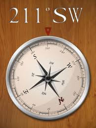
Looks like a real compass.
Function in all orientations.
Analog and digital readings


These are just a few of the many listed in the iTunes store. They come in all shapes and sizes and with many different features. Download a few of your favorites and always know where your headed!

~~~Sail On~~~ /)
Mark

Wednesday, November 21, 2012

A Marine "Black Friday"


Well, Thanksgiving has not even started yet and my wife is talking about Christmas shopping on BLACK FRIDAY. Many stores are planning to open even earlier than Friday. Some are opening their doors on Thanksgiving day at 8:00 pm. You have got to be kidding! This Christmas shopping is getting out of control.

People have been camping out all week in front of Best Buy and Walmart stores to catch the early deals on Christmas gifts.  I like to save a few bucks and get a good deal, but camping out in this weather?

If your like me, you probably have been getting alot of email notices about the "BLACK FRIDAY" events. I don't know if this is just an American phenomena but I thought it would be a good idea to share the Marine boating and sailing deals I have been hearing about.

We can all use a good deal on boat stuff.  It appears to me that if the word Marine is on the box it costs twice as much. Not to worry my boating friends, here are some holiday deals that will save you some serious cash!
West Marine is currently having a Holiday sale with some gift items 30% off from November 13-26th.  Check their site again on Friday for more great online deals.

On Thanksgiving Day they are having a 15% off sale on their entire site. Just use the code BIG15 at checkout.

Get your captain an eGift Card from West Marine, that will be sure to put a smile on his face!

Marine Depot is having a Black Friday event with saving of 10-50% on some items. Their sale runs through December 4th.

Mauri Pro Sailing is another great boating gear and prices. They are having a 30% off sale on their closeout items. You can get free shipping for orders over $75 in the US. Redeem the coupon SHUS.

Jamestown Distributors has many great items on sale for Christmas and you can get free shipping on items over $50.00 until November 26 by using redeeming the code THANKS.


Defender Marine is another quality site with great merchandise and prices. Check out their Holiday Sale items.


Bass Pro Shops is having a 5 DAY SALE with discounts up to 50% on hundreds of items through November 25th. 


Boating Savings.com has a event on Black Friday as well. Check out their great deals.

Amazon.com Black Friday always has the best prices and the greatest deals on the net. Check out their Marine Electronics section.


Overton's is a major supplier of boating and marine equipment. Check out their Black Friday specials. Everyday free shipping, no minimum order.


Island Nautical  also know as the New JSI Marine Supply is another one of my favorite marine stores. Check out their wide variety of marine supplies.


APPs On SALE

There are a ton of navigation apps going on sale on Black Friday also. Most of these are for land navigation but they might be useful on a road trip.

  • Garmin Street Pilot for the iPhone on sale for $24.99 was 49.99
  • Magellan Roadmate North America $44.99 was of $59.99 
  • Magellan RoadMate USA  $34.99 was of $49.99 
  • Magellan RoadMate Canada  $29.99 was of $34.99 
  • CoPilot Live USA for iPhone  $2.99
  • CoPilot Live North America for iPhone  $9.99
  • CoPilot Live HD North America app for iPad  $19.99 
  • NAVIGON Mobile Navigator iPhone USA  $29.99 was $49.99 
  • NAVIGON Mobile Navigator iPhone $19.99 was $29.99
  • TomTom US, Canada, or Mexico  $34.99 Nov. 26-30)
Good luck to all you shoppers who are going to brave the stores on Black Friday! May the force be with you. You will not see me fighting over the Tickle Me Elmo dolls, I will be home working on another great blog entry.

If you know of any great deals on Marine hardware or electronics, let me know and I will post them here!

~~~Sail On~~~ /)
Mark