Monday, December 19, 2011

DMK Yacht Instruments


Application: iPhone, iPad, iPod Touch
Function: Marine data and instrument display
Rating: ****
Cost: App is free, black box is $399.00 or with GPS 499.00

There are many communication protocols out there when it comes to marine instruments.  Many of us have the older NMEA 0183, while others may have upgraded to NMEA 2000.  If you have Raymarine on board you are dealing with SeaTalk. Some may have all three onboard.  The problem has always been how do we tie all of these together to make them available to our laptops, iPhones and iPads.  DMK has built a system to address this very problem.

DMK Yacht Instruments has put together a versatile data display app for your iPad, iPhone or iPod touch.  The app uses the UDP protocol over WiFi to retreive the data from the DMK proprietary black box that must be purchased separately.


iPhone view
App features include:
  • iOS 4.2+
  • iPad, iPhone, iPod Touch
  • Apparent Wind Speed
  • Apparent Wind Angle
  • Boat Speed
  • Depth Below Transducer
Black Box features include:
  • Accepts any combination of Raymarine SeaTalk®, NMEA 0183, and NMEA 2000 inputs
  • Uses WiFi to send the sentences for each protocol as UDP packet payload
  • Two NMEA 0183 connections
    Separately configurable baud rates: 4800, 9600, 19200, 38400, 57600, 114200
Main Instrument View

  • One Raymarine SeaTalk® connection
  • One NMEA 2000 connection
Includes an RP-SMA Wi-Fi rubber duck antenna
  • FCC-approved Wi-Fi transmitter
  • Requires external power DC: 5-12v
Model 11A-GPS Only
  • Built-in 14-channel GPS
  • Includes an external passive GPS antenna which connects via threaded SMA socket
  • 0183 GPS Out; use this to provide location data to e.g. a Standard Horizon AIS radio
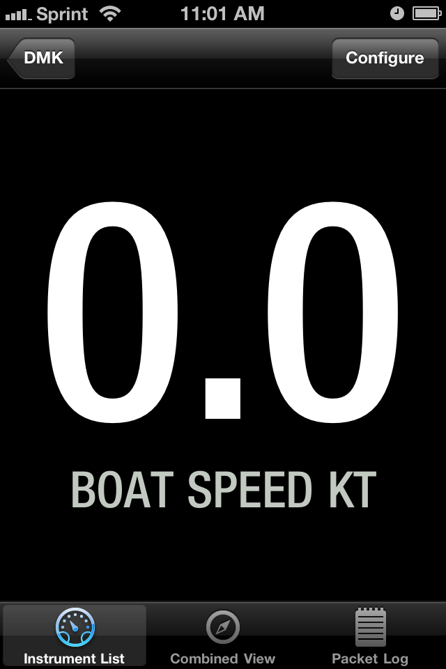


There are options to display the instrument by itself and change the options of the display. You can select digital or analog mode, fathoms, feet for meters for depth and options for Celsius of Fahrenheit for temperature.

 
These two screens allow you to manage logging and settings for the wireless network within the app.

I like that is has the flexibility to accept NMEA 0183, NMEA 2000 and SeaTalk protocols simultaneously.  This give you options if you have a mixture of different instrument types on your boat.  NMEA 2000 is the newest technology but there are still many of NMEA 0183 systems out there. If your a Raymarine fan SeaTalk is the protocol they use.

I don't like that the app only displays four instrument types.  Their webpage says that this is only a demonstration app. I assume DMK provides additional NMEA sentence support for other instruments.  DMK is selling the WiFi hardware for $399, or $499 if you want the GPS option.  iNavX is another app that can accept and display the data from the DMK box.  DMK uses port 1703 and UDP protocol. See the iNavX setup instructions here.  I assume other apps could be designed to access the data wirelessly through DMK's black box. Some apps allow the user to also use the iPhone or iPad's internal GPS for speed and location data. DMK's apps does not allow this.

There are cheaper options out there to connect your varied NMEA protocols to your iPad. Using the Actisense products to connect your NMEA 2000 or 0183 instruments to your laptop would be less expensive.  The laptop could then relay data via TCP/IP to an iPad app like iNavX or Mid +WiFi.

The Brookhouse iMux will connect your iPad or iPhone through WiFi to your NMEA 0183 and SeaTalk instruments.  There are lots of options our there. DMK has built a device to handle all the possible protocol options. Research which one fits your situation best and go with that. Hope this was helpful. What is everyone else using as a display app? Appreciate any feedback.


Sunday, December 4, 2011

Volvo Ocean Race - Leg 1 Recap

Telefonica wins first leg! Three of the six boats in this years Volvo Ocean Race have finished leg 1 in Cape Town, South Africa after 7480 miles of racing.  The other three boats suffered equipment failures and had to drop out of the first leg.  Sanya had problems with their hull separating and Puma and Abu Dhabi both lost their masts while racing.

Sanya and Abu Dhabi were shipped to Cape Town where repairs are underway. All boats plan to take part in the next leg of the race. Puma motored to the small island of Tristan da Cunha and has since been picked up by a freighter and is en route to Cape Town also.

In case you missed all the action you can see a great video highlighting the first leg of the race. See it here. http://www.youtube.com/watch?v=WqOsqvKARww&feature=player_embedded

Next on the schedule is an in port race on Saturday December 10th. Leg 2 of the race from Cape Town to Abu Dhabi is 6249 miles and will starts December 11th.

Follow all the action on the Volvo Ocean Race website.

Saturday, December 3, 2011

Tidal Chronoscope

Application: iPhone, iPad and iPod Touch
Function: Solar, Lunar and Tidal Info
Rating: ***
Cost: $2.99


Growing up in South Dakota and sailing on inland lakes I did not have to worry much about tides.  Tides as we all know are the daily rise and fall of the worlds oceans which are influenced by the gravitational pull of the sun and moon.  Many locations usually experience two high tides and two low tides each day.  Some places experience only one high and one low tide each day. Tides can range as high as 55 feet in the Bay of Fundy to a few inches in the Mediterranean and Caribbean. These extreme high tides occurs around the time of the full or new moon when the gravitational forces of both the Sun and Moon are in phase reinforcing each other.

Since I have been sailing on the oceans and coastal areas I have learned to pay attention to the daily tides. Coastal cruising in Florida has been especially interesting at times.  I was contacted by ChronGlobal and asked if I would take a look at their app and give my impressions about their Tidal Chronoscope app.

The Chronoscope comes is both an iOS and Android version so we all can enjoy this app. The app attempts to provide data in three different areas that are easily selected with the soft keys at the bottom of the app. Tidal, Solar and Lunar data are depicted on a watch or chronograph face. The whole idea of the watch faces seems confusing at first but after working with it for a while it grows on you. Some users have commented that it is hard to use and figure out. We all use a watch to tell time why not use it to show astronomical data.

Tidal Features:
  • Dedicated watch face for graphic and relative depiction of current state of the tides at current or any give time up to 7 days.
  • GPS location based for instant and current tide information for local or optional locations
  • Choice of over 9400 tide stations world wide
  • Tide watch shows how many hours to high and low tide
  • Information screen for detailed tide event
  • Tidal indicator depicts current moon phase for predicting neap and spring tides
  • Option setting of watch for up to 7 day predictions for hourly/minute future tide predication simply by setting the watch to desired date and time.
  • Option predicting future current tide time by the hour
  • Choose between meters and feet for tidal depth
  • Option for updating time and distance interval
  • A turn of the watch crown for minute and hour increments provides future tidal data.
  • A tap on the date provides a date and hour wheel for future time setting or manual adjustment
  • Save your favorite port.
  • Option to follow the tides of another location using your current time zone.
Lunar Features:
  • Dedicated watch face for a graphic depiction of current moon phase and relative position of the moon in the sky.
  • GPS location based
  • Indicates position of the moon in the visible sky
  • Striped moon indicates where moon is in non visible sky
  • Depicts moon phase and all progressive phases
  • Depicts moon rise and moon set
  • Depicts the moon as it transits the visible and non visible sky
  • Predict moon position and phase up to 7 days by the hour or day by simply setting the watch to desired date and time
  • ‘Moon over’ and ‘Moon under’ depiction
  • A turn of the watch crown for minute and hour increments provides future moon data
  • A tap on the date provides a date and hour wheel for future time setting or manual adjustment
Solar Features:
  • Dedicated watch face for a graphic depiction of the current and relative position of the sun in the visible and non visible sky
  • GPS location based
  • Indicates relative position of the Sun in your location
  • Yellow sun indicates in visible sky
  • Blanked out sun indicates moon in non visible sky
  • Sunrise and sunset depiction
  • 7 day prediction up to 7 days by the hour or day by simply resetting the watch
  • A turn of the watch crown for minute and hour increments provides future sun data
  • A tap on the date provides a date and hour wheel for future time setting or manual adjustment
The app is very versatile and allows you to customize the look of your chronograph with several different styles and colors. If your looking for a unique and fun way of looking at Tide, Solar an Lunar data, check out ChronGlobal's Chronoscope app.

Friday, November 25, 2011

AIS Radar

Application: iPhone, iPad
Function: AIS charting and information
Rating: **
Cost: $11.99


AIS can be used by the long distance cruiser or the weekend coastal boater to add a level of safety. AIS Radar is a reasonably priced app that will give you some basic AIS functionality.


AIS stands for Automatic Identification System.  Large international commercial ships and all passenger ships are required by law to broadcast AIS data to prevent collision and increase safety while at sea.  It is estimated that there are about 40,000 ships currently carry AIS class A equipment. The new Class B AIS standard was introduced in 2007 and created a new generation of low cost AIS transceivers.  AIS will not replace conventional radar but can be used to assist the yachtsman in collision avoidance.

AIS is becoming more popular with the advent of cheaper software and hardware. AIS uses VHF frequencies to broadcast and receive the AIS data and targets. AIS Radar can display data received from marine AIS transponders such as the ExNC 101 Class B AIS Transponder over a WiFi network. For AIS transponders or receivers without built-in WiFi support, an external serial WiFi adapter such as the SEAMate1A Lite, the Brookhouse iMux, the Roving Networks RN-370 or the Digi Connect® Wi-SP can be used.

Data from public AIS networks can optionally be displayed from the Internet.

Features:
  • Radar like display of AIS data and targets.
  • Course, heading and speed information of targets
  • Variable radar display range
  • Multiple symbols for AIS targets. Class A and class B transponders.
  • Computes CPA, closest point of approach and TCPA, time to closest point of approach.
  • Multitouch gestures to select display range
  • Display modes of heading up, course up and north up
  • Options to hide slow moving targets from radar display
  • List of AIS targets and display all information about the targets
  • Viewer for AIS safely related broadcast messages
Four soft keys, Radar, Targets, Messages and Settings are used to navigate within the app. The radar like display shows real time AIS targets. Targets are shown with different symbols depending on if they are AIS A or B. The app allows different radar ranges to be selected with multi touch gestures.

The Targets display gives you a list of AIS targets which can be selected to give more details. The name, call sign, type, status, speed, course and heading can all be viewed.

The price of app at $11.99 is reasonable if your just looking for a stand alone AIS app. The one draw back is that it does not display the targets on a marine chart. There are several charting apps that do also include AIS displays.  If you have the iNavx app the AIS display is integrated into the charting display.  I have a list of the Top 5 Best AIS apps listed on my blog. Check them all out and see which one fits your needs.

Saturday, November 19, 2011

Digital Yacht - iOnboard

Application: iPhone, iPad, iPod touch
Function: Marine data display
Rating: ***
Cost: $6.99

Digital Yacht has had quite a year with an introduction of many new electronics for the yachting enthusiast. They were just recently awarded the DAME 2011 NMEA award for marine electronics. The company creates devices that take your onboard navigation, instrumentation and AIS data and through WiFi makes this data available to mobile devices. The Digital Yacht WLN10 NMEA to wireless server the BOATraNet and iAIS systems provide these wireless data networks.

The iOnboard app is used on your iPhone or iPad to display the data from the wireless network. GPS data, instrumentation, navigation and AIS data are easily viewed when and where you want.  The iPad or iPhone are more mobile and less expensive than a full blown stand alone multifunction display.  Through a wireless TCP/IP link the data is transferred from the onboard server to your mobile device.

The app has four soft keys across the bottom. These access the GPS, navigation, instruments and settings pages.  The GPS page list the typical GPS coordinates, speed and course over ground, date and time. Additional pages show the list of GPS satellites and locations.


The navigation pages show course, heading and track displays to keep you on course. The instrument pages provide gauge like dials showing additional navigation instrument.

Digital Yacht also has another free app called Digital AIS.  This app displays AIS data on your mobile device from an onboard wireless AIS network.

The Automatic Identification System (AIS) is an automated tracking system used on ships and by Vessel Tracking Services for identifying and locating ships by electronically exchanging data with other nearby ships and VTS stations.

The Digital AIS app has a radar like display showing ships in your area and provides important information about the ships name, speed, course, heading and length.  AIS is valuable tool to keep track of possible collision courses with surrounding ship traffic. 

Both of these apps require that that you have onboard instrumentation networks and a WiFi network setup to broadcast the NMEA data. If all of your ships data is connected to your laptop you can set up an adhoc network to send this data to your mobile devices.  Digital Yacht has several WiFi devices that can be setup to create a WiFi network on your boat also.  There are many data display apps out there. The iOnboard app provides similar data to the NMEA Remote and MID+WiFi apps that I have reviewed. At $6.99 for the iPad version this is cheaper than the other two.  Take a good look at them all to see what fits your needs the best.